You are here: Home > Network List > US - United States National Seismic Network Stations List
> Station DUG Dugway, Tooele County, Utah, USA > Earthquake Result Viewer
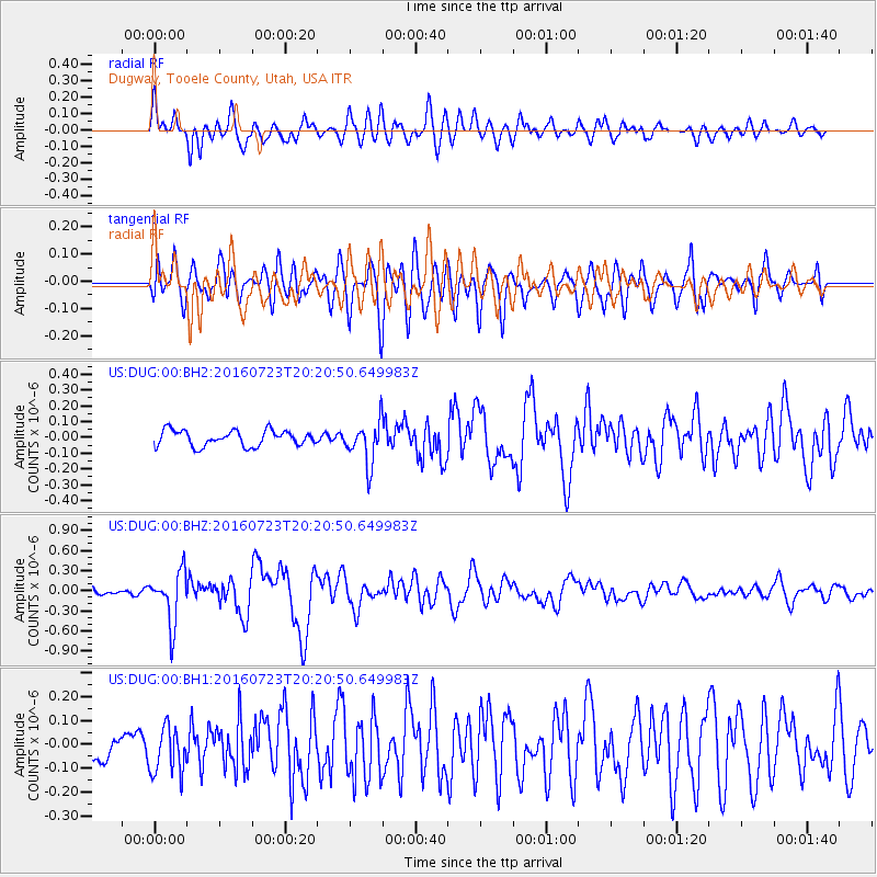
DUG Dugway, Tooele County, Utah, USA - Earthquake Result Viewer
*The percent match for this event was below the threshold and hence no stack was calculated.
| Earthquake location: |
Tonga Islands |
| Earthquake latitude/longitude: |
-15.1/-173.6 |
| Earthquake time(UTC): |
2016/07/23 (205) 20:09:19 GMT |
| Earthquake Depth: |
10 km |
| Earthquake Magnitude: |
5.7 MB |
| Earthquake Catalog/Contributor: |
NEIC PDE/NEIC COMCAT |
|
| Network: |
US United States National Seismic Network |
| Station: |
DUG Dugway, Tooele County, Utah, USA |
| Lat/Lon: |
40.19 N/112.81 W |
| Elevation: |
1477 m |
|
| Distance: |
78.8 deg |
| Az: |
42.979 deg |
| Baz: |
239.282 deg |
| Ray Param: |
$rayparam |
*The percent match for this event was below the threshold and hence was not used in the summary stack. |
|
| Radial Match: |
74.28698 % |
| Radial Bump: |
400 |
| Transverse Match: |
73.42484 % |
| Transverse Bump: |
400 |
| SOD ConfigId: |
1634031 |
| Insert Time: |
2016-08-06 20:31:14.807 +0000 |
| GWidth: |
2.5 |
| Max Bumps: |
400 |
| Tol: |
0.001 |
|
Signal To Noise
| Channel | StoN | STA | LTA |
| US:DUG:00:BHZ:20160723T20:20:50.649983Z | 7.5089145 | 3.854574E-7 | 5.1333306E-8 |
| US:DUG:00:BH1:20160723T20:20:50.649983Z | 1.5760711 | 9.835478E-8 | 6.240504E-8 |
| US:DUG:00:BH2:20160723T20:20:50.649983Z | 2.743185 | 1.3484431E-7 | 4.915611E-8 |
| Arrivals |
| Ps | |
| PpPs | |
| PsPs/PpSs | |


