You are here: Home > Network List > TA - USArray Transportable Network (new EarthScope stations) Stations List
> Station J13A Cove Ranch, Picabo, ID, USA > Earthquake Result Viewer
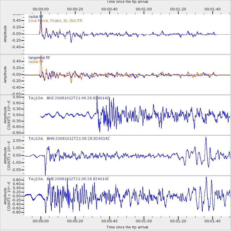
J13A Cove Ranch, Picabo, ID, USA - Earthquake Result Viewer
*The percent match for this event was below the threshold and hence no stack was calculated.
| Earthquake location: |
Southern Bolivia |
| Earthquake latitude/longitude: |
-20.1/-65.0 |
| Earthquake time(UTC): |
2008/10/12 (286) 20:55:41 GMT |
| Earthquake Depth: |
353 km |
| Earthquake Magnitude: |
6.0 MB, 6.2 MW, 6.2 MW |
| Earthquake Catalog/Contributor: |
WHDF/NEIC |
|
| Network: |
TA USArray Transportable Network (new EarthScope stations) |
| Station: |
J13A Cove Ranch, Picabo, ID, USA |
| Lat/Lon: |
43.40 N/114.17 W |
| Elevation: |
1552 m |
|
| Distance: |
77.7 deg |
| Az: |
325.611 deg |
| Baz: |
133.268 deg |
| Ray Param: |
$rayparam |
*The percent match for this event was below the threshold and hence was not used in the summary stack. |
|
| Radial Match: |
79.374146 % |
| Radial Bump: |
400 |
| Transverse Match: |
60.544895 % |
| Transverse Bump: |
400 |
| SOD ConfigId: |
2556 |
| Insert Time: |
2010-03-06 16:04:06.593 +0000 |
| GWidth: |
2.5 |
| Max Bumps: |
400 |
| Tol: |
0.001 |
|
Signal To Noise
| Channel | StoN | STA | LTA |
| TA:J13A: :BHN:20081012T21:06:28.824014Z | 7.524325 | 8.173395E-7 | 1.08626296E-7 |
| TA:J13A: :BHE:20081012T21:06:28.824014Z | 3.7913265 | 2.7777685E-7 | 7.32664E-8 |
| TA:J13A: :BHZ:20081012T21:06:28.824014Z | 5.060232 | 3.4542603E-7 | 6.826288E-8 |
| Arrivals |
| Ps | |
| PpPs | |
| PsPs/PpSs | |


