You are here: Home > Network List > US - United States National Seismic Network Stations List
> Station MSO Missoula, Montana, USA > Earthquake Result Viewer
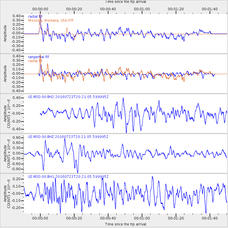
MSO Missoula, Montana, USA - Earthquake Result Viewer
*The percent match for this event was below the threshold and hence no stack was calculated.
| Earthquake location: |
Tonga Islands |
| Earthquake latitude/longitude: |
-15.1/-173.6 |
| Earthquake time(UTC): |
2016/07/23 (205) 20:09:19 GMT |
| Earthquake Depth: |
10 km |
| Earthquake Magnitude: |
5.7 MB |
| Earthquake Catalog/Contributor: |
NEIC PDE/NEIC COMCAT |
|
| Network: |
US United States National Seismic Network |
| Station: |
MSO Missoula, Montana, USA |
| Lat/Lon: |
46.83 N/113.94 W |
| Elevation: |
1264 m |
|
| Distance: |
81.6 deg |
| Az: |
36.813 deg |
| Baz: |
237.454 deg |
| Ray Param: |
$rayparam |
*The percent match for this event was below the threshold and hence was not used in the summary stack. |
|
| Radial Match: |
70.699066 % |
| Radial Bump: |
400 |
| Transverse Match: |
73.039734 % |
| Transverse Bump: |
400 |
| SOD ConfigId: |
1634031 |
| Insert Time: |
2016-08-06 20:32:28.295 +0000 |
| GWidth: |
2.5 |
| Max Bumps: |
400 |
| Tol: |
0.001 |
|
Signal To Noise
| Channel | StoN | STA | LTA |
| US:MSO:00:BHZ:20160723T20:21:05.599995Z | 7.121195 | 4.1448732E-7 | 5.820474E-8 |
| US:MSO:00:BH1:20160723T20:21:05.599995Z | 1.2180663 | 7.3115864E-8 | 6.0026174E-8 |
| US:MSO:00:BH2:20160723T20:21:05.599995Z | 2.4215539 | 1.7106088E-7 | 7.064096E-8 |
| Arrivals |
| Ps | |
| PpPs | |
| PsPs/PpSs | |


