You are here: Home > Network List > CN - Canadian National Seismograph Network Stations List
> Station INK INUVIK, NT > Earthquake Result Viewer
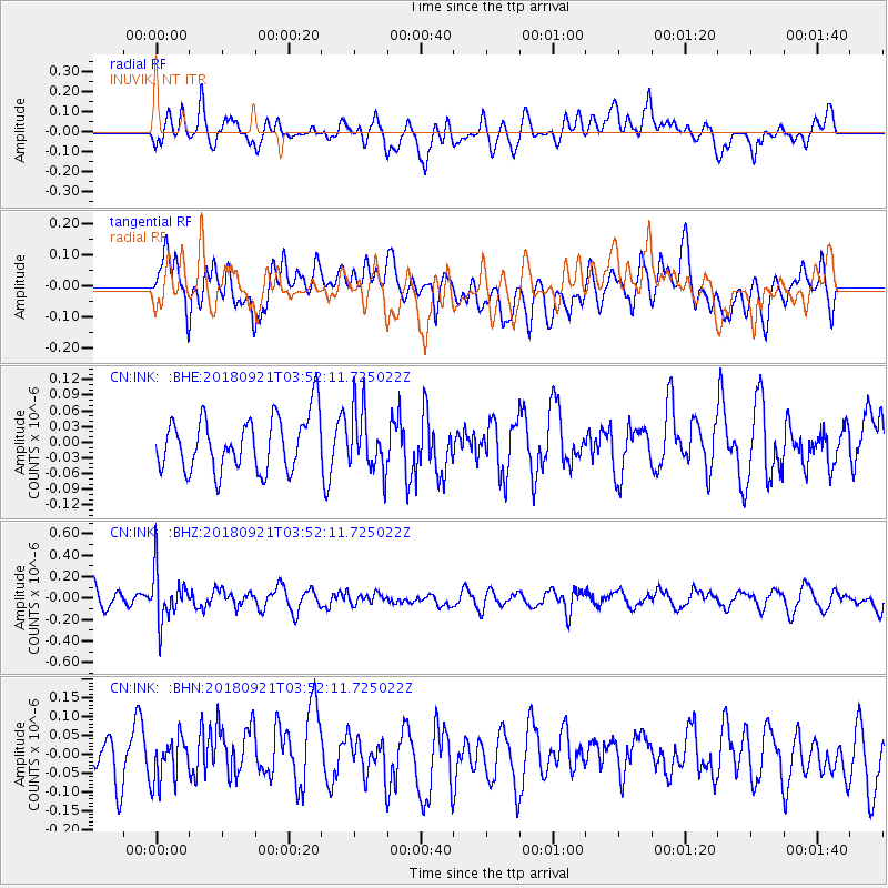
INK INUVIK, NT - Earthquake Result Viewer
*The percent match for this event was below the threshold and hence no stack was calculated.
| Earthquake location: |
Fiji Islands Region |
| Earthquake latitude/longitude: |
-17.9/-179.9 |
| Earthquake time(UTC): |
2018/09/21 (264) 03:40:40 GMT |
| Earthquake Depth: |
653 km |
| Earthquake Magnitude: |
5.9 Mww |
| Earthquake Catalog/Contributor: |
NEIC PDE/us |
|
| Network: |
CN Canadian National Seismograph Network |
| Station: |
INK INUVIK, NT |
| Lat/Lon: |
68.31 N/133.53 W |
| Elevation: |
44 m |
|
| Distance: |
92.3 deg |
| Az: |
15.638 deg |
| Baz: |
223.657 deg |
| Ray Param: |
$rayparam |
*The percent match for this event was below the threshold and hence was not used in the summary stack. |
|
| Radial Match: |
63.857765 % |
| Radial Bump: |
400 |
| Transverse Match: |
46.52964 % |
| Transverse Bump: |
400 |
| SOD ConfigId: |
13570011 |
| Insert Time: |
2019-05-01 07:14:20.649 +0000 |
| GWidth: |
2.5 |
| Max Bumps: |
400 |
| Tol: |
0.001 |
|
Signal To Noise
| Channel | StoN | STA | LTA |
| CN:INK: :BHZ:20180921T03:52:11.725022Z | 2.2067358 | 2.3279456E-7 | 1.0549272E-7 |
| CN:INK: :BHN:20180921T03:52:11.725022Z | 1.2200931 | 5.8406396E-8 | 4.7870444E-8 |
| CN:INK: :BHE:20180921T03:52:11.725022Z | 1.1267762 | 5.819423E-8 | 5.1646662E-8 |
| Arrivals |
| Ps | |
| PpPs | |
| PsPs/PpSs | |


