You are here: Home > Network List > TA - USArray Transportable Network (new EarthScope stations) Stations List
> Station J13A Cove Ranch, Picabo, ID, USA > Earthquake Result Viewer
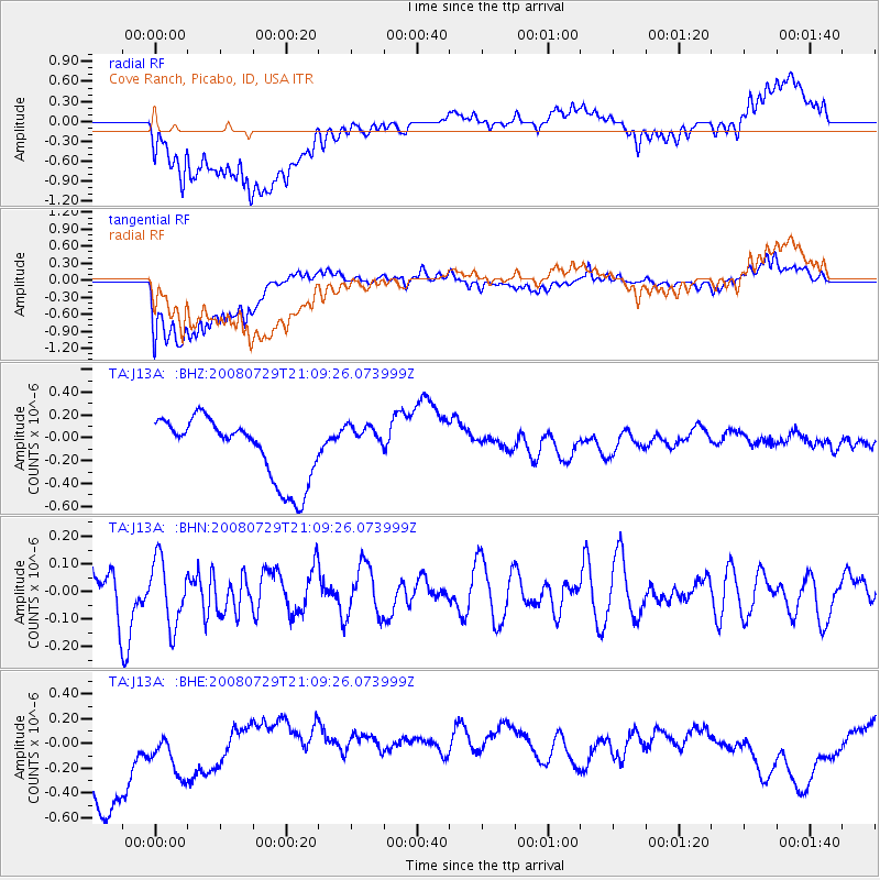
J13A Cove Ranch, Picabo, ID, USA - Earthquake Result Viewer
*The percent match for this event was below the threshold and hence no stack was calculated.
| Earthquake location: |
Southern East Pacific Rise |
| Earthquake latitude/longitude: |
-54.7/-118.8 |
| Earthquake time(UTC): |
2008/07/29 (211) 20:56:22 GMT |
| Earthquake Depth: |
10 km |
| Earthquake Magnitude: |
5.5 MB, 5.4 MS, 5.8 MW, 5.7 MW |
| Earthquake Catalog/Contributor: |
WHDF/NEIC |
|
| Network: |
TA USArray Transportable Network (new EarthScope stations) |
| Station: |
J13A Cove Ranch, Picabo, ID, USA |
| Lat/Lon: |
43.40 N/114.17 W |
| Elevation: |
1552 m |
|
| Distance: |
97.8 deg |
| Az: |
3.389 deg |
| Baz: |
182.697 deg |
| Ray Param: |
$rayparam |
*The percent match for this event was below the threshold and hence was not used in the summary stack. |
|
| Radial Match: |
46.92834 % |
| Radial Bump: |
400 |
| Transverse Match: |
70.140274 % |
| Transverse Bump: |
400 |
| SOD ConfigId: |
2504 |
| Insert Time: |
2010-03-06 16:05:11.167 +0000 |
| GWidth: |
2.5 |
| Max Bumps: |
400 |
| Tol: |
0.001 |
|
Signal To Noise
| Channel | StoN | STA | LTA |
| TA:J13A: :BHN:20080729T21:09:26.073999Z | 1.6218698 | 1.1704698E-7 | 7.216793E-8 |
| TA:J13A: :BHE:20080729T21:09:26.073999Z | 0.76772696 | 2.5275142E-7 | 3.2922046E-7 |
| TA:J13A: :BHZ:20080729T21:09:26.073999Z | 0.60832155 | 1.6526177E-7 | 2.7166845E-7 |
| Arrivals |
| Ps | |
| PpPs | |
| PsPs/PpSs | |


