You are here: Home > Network List > TA - USArray Transportable Network (new EarthScope stations) Stations List
> Station J26L Joseph Creek, AK, USA > Earthquake Result Viewer
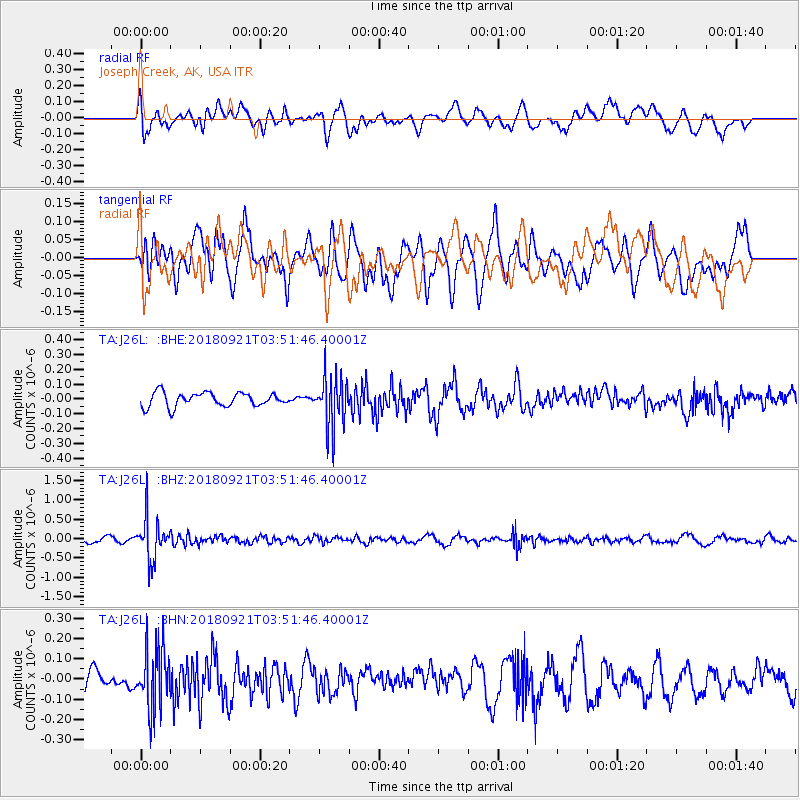
J26L Joseph Creek, AK, USA - Earthquake Result Viewer
*The percent match for this event was below the threshold and hence no stack was calculated.
| Earthquake location: |
Fiji Islands Region |
| Earthquake latitude/longitude: |
-17.9/-179.9 |
| Earthquake time(UTC): |
2018/09/21 (264) 03:40:40 GMT |
| Earthquake Depth: |
653 km |
| Earthquake Magnitude: |
5.9 Mww |
| Earthquake Catalog/Contributor: |
NEIC PDE/us |
|
| Network: |
TA USArray Transportable Network (new EarthScope stations) |
| Station: |
J26L Joseph Creek, AK, USA |
| Lat/Lon: |
64.50 N/143.56 W |
| Elevation: |
1144 m |
|
| Distance: |
86.8 deg |
| Az: |
14.903 deg |
| Baz: |
214.453 deg |
| Ray Param: |
$rayparam |
*The percent match for this event was below the threshold and hence was not used in the summary stack. |
|
| Radial Match: |
55.497837 % |
| Radial Bump: |
400 |
| Transverse Match: |
62.45743 % |
| Transverse Bump: |
400 |
| SOD ConfigId: |
13570011 |
| Insert Time: |
2019-05-01 07:18:51.954 +0000 |
| GWidth: |
2.5 |
| Max Bumps: |
400 |
| Tol: |
0.001 |
|
Signal To Noise
| Channel | StoN | STA | LTA |
| TA:J26L: :BHZ:20180921T03:51:46.40001Z | 5.923109 | 5.3020824E-7 | 8.95152E-8 |
| TA:J26L: :BHN:20180921T03:51:46.40001Z | 2.4632745 | 1.5067464E-7 | 6.116843E-8 |
| TA:J26L: :BHE:20180921T03:51:46.40001Z | 3.585431 | 1.6824747E-7 | 4.6925308E-8 |
| Arrivals |
| Ps | |
| PpPs | |
| PsPs/PpSs | |


