You are here: Home > Network List > TA - USArray Transportable Network (new EarthScope stations) Stations List
> Station O18K Koktuh Hills, AK, USA > Earthquake Result Viewer
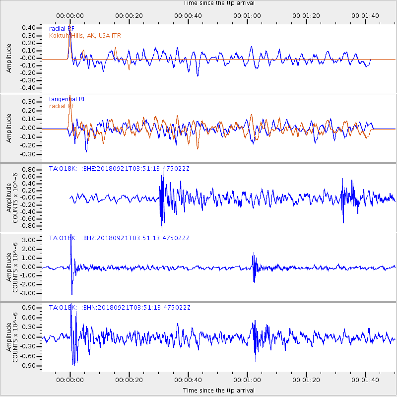
O18K Koktuh Hills, AK, USA - Earthquake Result Viewer
*The percent match for this event was below the threshold and hence no stack was calculated.
| Earthquake location: |
Fiji Islands Region |
| Earthquake latitude/longitude: |
-17.9/-179.9 |
| Earthquake time(UTC): |
2018/09/21 (264) 03:40:40 GMT |
| Earthquake Depth: |
653 km |
| Earthquake Magnitude: |
5.9 Mww |
| Earthquake Catalog/Contributor: |
NEIC PDE/us |
|
| Network: |
TA USArray Transportable Network (new EarthScope stations) |
| Station: |
O18K Koktuh Hills, AK, USA |
| Lat/Lon: |
59.85 N/155.21 W |
| Elevation: |
544 m |
|
| Distance: |
80.1 deg |
| Az: |
12.384 deg |
| Baz: |
203.864 deg |
| Ray Param: |
$rayparam |
*The percent match for this event was below the threshold and hence was not used in the summary stack. |
|
| Radial Match: |
69.823456 % |
| Radial Bump: |
400 |
| Transverse Match: |
63.371048 % |
| Transverse Bump: |
400 |
| SOD ConfigId: |
13570011 |
| Insert Time: |
2019-05-01 07:19:33.407 +0000 |
| GWidth: |
2.5 |
| Max Bumps: |
400 |
| Tol: |
0.001 |
|
Signal To Noise
| Channel | StoN | STA | LTA |
| TA:O18K: :BHZ:20180921T03:51:13.475022Z | 9.943306 | 1.0113745E-6 | 1.0171411E-7 |
| TA:O18K: :BHN:20180921T03:51:13.475022Z | 4.8756194 | 4.210512E-7 | 8.6358504E-8 |
| TA:O18K: :BHE:20180921T03:51:13.475022Z | 5.139925 | 3.3504546E-7 | 6.518489E-8 |
| Arrivals |
| Ps | |
| PpPs | |
| PsPs/PpSs | |


