You are here: Home > Network List > TA - USArray Transportable Network (new EarthScope stations) Stations List
> Station G22K Bettles, AK, USA > Earthquake Result Viewer
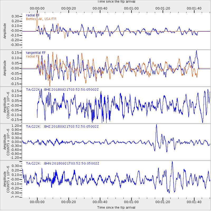
G22K Bettles, AK, USA - Earthquake Result Viewer
*The percent match for this event was below the threshold and hence no stack was calculated.
| Earthquake location: |
Fiji Islands Region |
| Earthquake latitude/longitude: |
-17.8/-179.9 |
| Earthquake time(UTC): |
2018/09/21 (264) 03:41:41 GMT |
| Earthquake Depth: |
639 km |
| Earthquake Magnitude: |
5.7 Mwb |
| Earthquake Catalog/Contributor: |
NEIC PDE/us |
|
| Network: |
TA USArray Transportable Network (new EarthScope stations) |
| Station: |
G22K Bettles, AK, USA |
| Lat/Lon: |
66.92 N/151.51 W |
| Elevation: |
205 m |
|
| Distance: |
87.1 deg |
| Az: |
10.812 deg |
| Baz: |
206.951 deg |
| Ray Param: |
$rayparam |
*The percent match for this event was below the threshold and hence was not used in the summary stack. |
|
| Radial Match: |
44.453857 % |
| Radial Bump: |
400 |
| Transverse Match: |
58.453205 % |
| Transverse Bump: |
400 |
| SOD ConfigId: |
13570011 |
| Insert Time: |
2019-05-01 07:27:53.531 +0000 |
| GWidth: |
2.5 |
| Max Bumps: |
400 |
| Tol: |
0.001 |
|
Signal To Noise
| Channel | StoN | STA | LTA |
| TA:G22K: :BHZ:20180921T03:52:50.05002Z | 1.3375411 | 9.432537E-8 | 7.052147E-8 |
| TA:G22K: :BHN:20180921T03:52:50.05002Z | 0.9499709 | 9.2668074E-8 | 9.754833E-8 |
| TA:G22K: :BHE:20180921T03:52:50.05002Z | 1.1864917 | 7.612978E-8 | 6.4163764E-8 |
| Arrivals |
| Ps | |
| PpPs | |
| PsPs/PpSs | |


