You are here: Home > Network List > AV - Alaska Volcano Observatory Stations List
> Station MAPS Pakushin Southeast, Makushin Volcano, Alaska > Earthquake Result Viewer
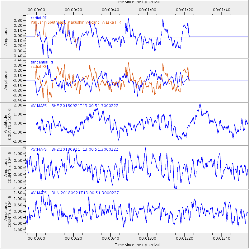
MAPS Pakushin Southeast, Makushin Volcano, Alaska - Earthquake Result Viewer
*The percent match for this event was below the threshold and hence no stack was calculated.
| Earthquake location: |
Galapagos Islands Region |
| Earthquake latitude/longitude: |
2.4/-95.5 |
| Earthquake time(UTC): |
2018/09/21 (264) 12:49:28 GMT |
| Earthquake Depth: |
10 km |
| Earthquake Magnitude: |
5.7 Mww |
| Earthquake Catalog/Contributor: |
NEIC PDE/us |
|
| Network: |
AV Alaska Volcano Observatory |
| Station: |
MAPS Pakushin Southeast, Makushin Volcano, Alaska |
| Lat/Lon: |
53.81 N/166.94 W |
| Elevation: |
333 m |
|
| Distance: |
77.2 deg |
| Az: |
324.781 deg |
| Baz: |
103.7 deg |
| Ray Param: |
$rayparam |
*The percent match for this event was below the threshold and hence was not used in the summary stack. |
|
| Radial Match: |
48.217854 % |
| Radial Bump: |
400 |
| Transverse Match: |
47.472073 % |
| Transverse Bump: |
400 |
| SOD ConfigId: |
13570011 |
| Insert Time: |
2019-05-01 07:31:48.987 +0000 |
| GWidth: |
2.5 |
| Max Bumps: |
400 |
| Tol: |
0.001 |
|
Signal To Noise
| Channel | StoN | STA | LTA |
| AV:MAPS: :BHZ:20180921T13:00:51.300022Z | 1.1558741 | 6.0359446E-7 | 5.221974E-7 |
| AV:MAPS: :BHN:20180921T13:00:51.300022Z | 2.308191 | 9.004983E-7 | 3.9013162E-7 |
| AV:MAPS: :BHE:20180921T13:00:51.300022Z | 3.2913833 | 1.5341769E-6 | 4.661192E-7 |
| Arrivals |
| Ps | |
| PpPs | |
| PsPs/PpSs | |


