You are here: Home > Network List > CN - Canadian National Seismograph Network Stations List
> Station INK INUVIK, NT > Earthquake Result Viewer
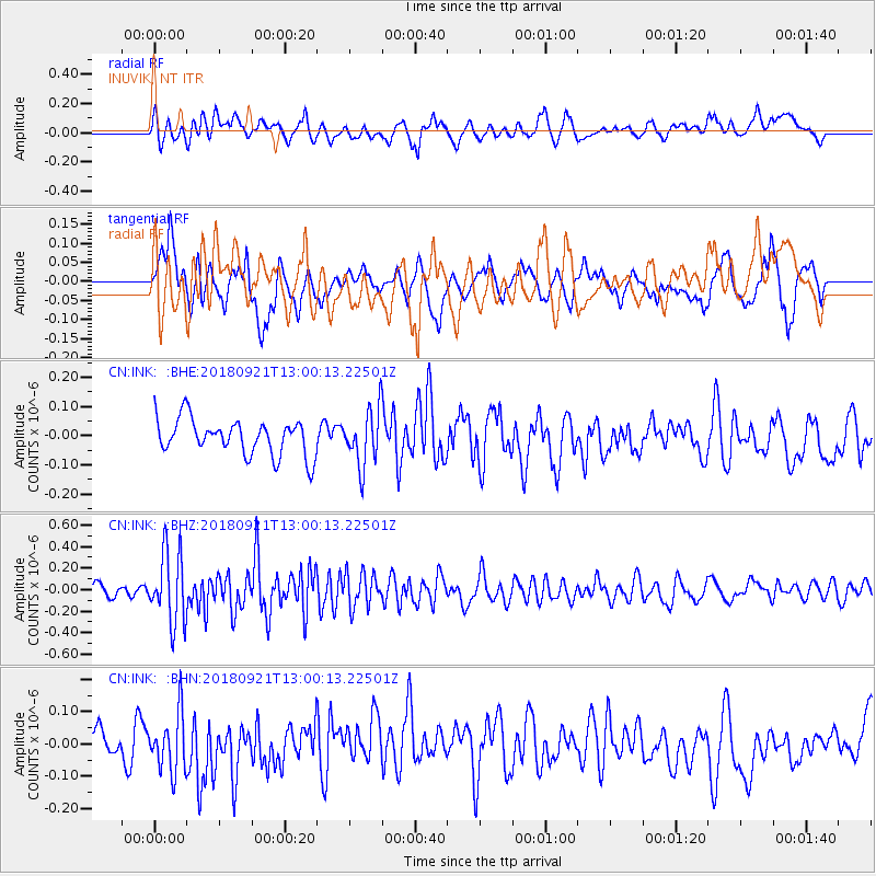
INK INUVIK, NT - Earthquake Result Viewer
*The percent match for this event was below the threshold and hence no stack was calculated.
| Earthquake location: |
Galapagos Islands Region |
| Earthquake latitude/longitude: |
2.4/-95.5 |
| Earthquake time(UTC): |
2018/09/21 (264) 12:49:28 GMT |
| Earthquake Depth: |
10 km |
| Earthquake Magnitude: |
5.7 Mww |
| Earthquake Catalog/Contributor: |
NEIC PDE/us |
|
| Network: |
CN Canadian National Seismograph Network |
| Station: |
INK INUVIK, NT |
| Lat/Lon: |
68.31 N/133.53 W |
| Elevation: |
44 m |
|
| Distance: |
70.6 deg |
| Az: |
345.945 deg |
| Baz: |
139.259 deg |
| Ray Param: |
$rayparam |
*The percent match for this event was below the threshold and hence was not used in the summary stack. |
|
| Radial Match: |
60.39685 % |
| Radial Bump: |
400 |
| Transverse Match: |
58.382072 % |
| Transverse Bump: |
400 |
| SOD ConfigId: |
13570011 |
| Insert Time: |
2019-05-01 07:33:40.346 +0000 |
| GWidth: |
2.5 |
| Max Bumps: |
400 |
| Tol: |
0.001 |
|
Signal To Noise
| Channel | StoN | STA | LTA |
| CN:INK: :BHZ:20180921T13:00:13.22501Z | 4.6191907 | 3.305384E-7 | 7.155764E-8 |
| CN:INK: :BHN:20180921T13:00:13.22501Z | 1.2438537 | 8.927601E-8 | 7.177372E-8 |
| CN:INK: :BHE:20180921T13:00:13.22501Z | 1.5578165 | 9.546243E-8 | 6.1279636E-8 |
| Arrivals |
| Ps | |
| PpPs | |
| PsPs/PpSs | |


