You are here: Home > Network List > TA - USArray Transportable Network (new EarthScope stations) Stations List
> Station 121A Cookes Peak, Deming, NM, USA > Earthquake Result Viewer
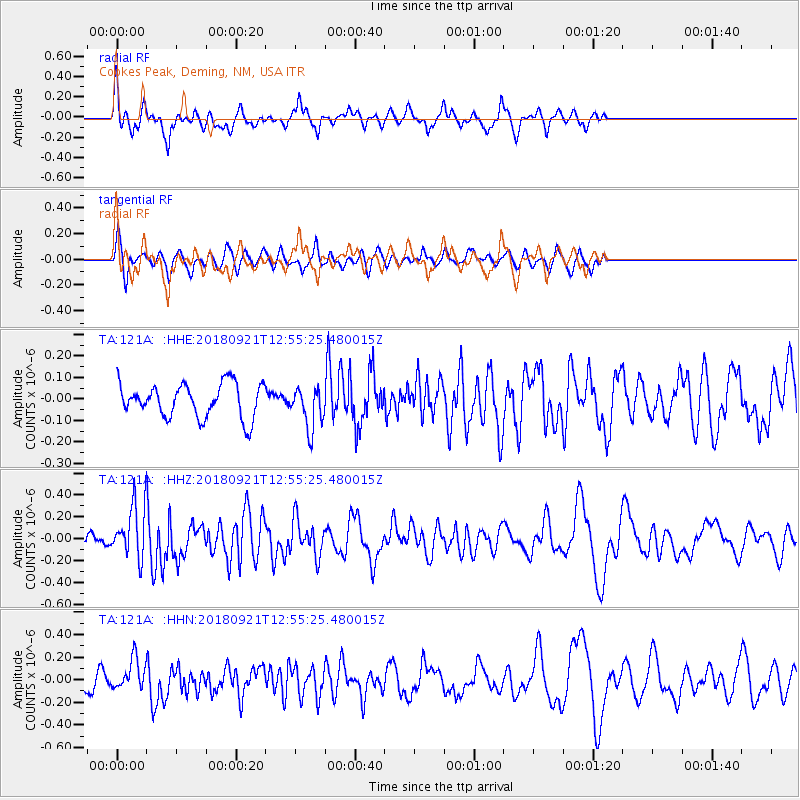
121A Cookes Peak, Deming, NM, USA - Earthquake Result Viewer
*The percent match for this event was below the threshold and hence no stack was calculated.
| Earthquake location: |
Galapagos Islands Region |
| Earthquake latitude/longitude: |
2.4/-95.5 |
| Earthquake time(UTC): |
2018/09/21 (264) 12:49:28 GMT |
| Earthquake Depth: |
10 km |
| Earthquake Magnitude: |
5.7 Mww |
| Earthquake Catalog/Contributor: |
NEIC PDE/us |
|
| Network: |
TA USArray Transportable Network (new EarthScope stations) |
| Station: |
121A Cookes Peak, Deming, NM, USA |
| Lat/Lon: |
32.53 N/107.79 W |
| Elevation: |
1652 m |
|
| Distance: |
32.1 deg |
| Az: |
340.203 deg |
| Baz: |
156.385 deg |
| Ray Param: |
$rayparam |
*The percent match for this event was below the threshold and hence was not used in the summary stack. |
|
| Radial Match: |
66.851395 % |
| Radial Bump: |
391 |
| Transverse Match: |
69.37522 % |
| Transverse Bump: |
317 |
| SOD ConfigId: |
13570011 |
| Insert Time: |
2019-05-01 07:37:43.508 +0000 |
| GWidth: |
2.5 |
| Max Bumps: |
400 |
| Tol: |
0.001 |
|
Signal To Noise
| Channel | StoN | STA | LTA |
| TA:121A: :HHZ:20180921T12:55:25.480015Z | 3.7947733 | 2.3040711E-7 | 6.0716964E-8 |
| TA:121A: :HHN:20180921T12:55:25.480015Z | 2.2671115 | 1.320261E-7 | 5.8235376E-8 |
| TA:121A: :HHE:20180921T12:55:25.480015Z | 1.2340086 | 9.675401E-8 | 7.8406266E-8 |
| Arrivals |
| Ps | |
| PpPs | |
| PsPs/PpSs | |


