You are here: Home > Network List > TA - USArray Transportable Network (new EarthScope stations) Stations List
> Station H31M Peel River, Yukon, CAN > Earthquake Result Viewer
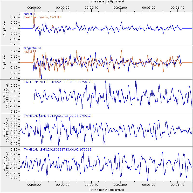
H31M Peel River, Yukon, CAN - Earthquake Result Viewer
*The percent match for this event was below the threshold and hence no stack was calculated.
| Earthquake location: |
Galapagos Islands Region |
| Earthquake latitude/longitude: |
2.4/-95.5 |
| Earthquake time(UTC): |
2018/09/21 (264) 12:49:28 GMT |
| Earthquake Depth: |
10 km |
| Earthquake Magnitude: |
5.7 Mww |
| Earthquake Catalog/Contributor: |
NEIC PDE/us |
|
| Network: |
TA USArray Transportable Network (new EarthScope stations) |
| Station: |
H31M Peel River, Yukon, CAN |
| Lat/Lon: |
65.81 N/134.34 W |
| Elevation: |
642 m |
|
| Distance: |
69.0 deg |
| Az: |
343.916 deg |
| Baz: |
137.806 deg |
| Ray Param: |
$rayparam |
*The percent match for this event was below the threshold and hence was not used in the summary stack. |
|
| Radial Match: |
60.334896 % |
| Radial Bump: |
400 |
| Transverse Match: |
62.98501 % |
| Transverse Bump: |
400 |
| SOD ConfigId: |
13570011 |
| Insert Time: |
2019-05-01 07:38:18.168 +0000 |
| GWidth: |
2.5 |
| Max Bumps: |
400 |
| Tol: |
0.001 |
|
Signal To Noise
| Channel | StoN | STA | LTA |
| TA:H31M: :BHZ:20180921T13:00:02.97501Z | 2.9057167 | 1.868481E-7 | 6.430362E-8 |
| TA:H31M: :BHN:20180921T13:00:02.97501Z | 1.2209579 | 8.416595E-8 | 6.8934355E-8 |
| TA:H31M: :BHE:20180921T13:00:02.97501Z | 1.4429098 | 9.720774E-8 | 6.7369236E-8 |
| Arrivals |
| Ps | |
| PpPs | |
| PsPs/PpSs | |


