You are here: Home > Network List > TA - USArray Transportable Network (new EarthScope stations) Stations List
> Station J26L Joseph Creek, AK, USA > Earthquake Result Viewer
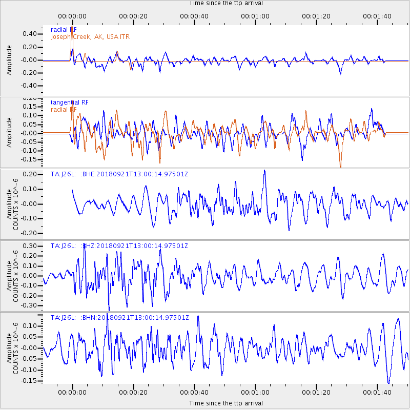
J26L Joseph Creek, AK, USA - Earthquake Result Viewer
*The percent match for this event was below the threshold and hence no stack was calculated.
| Earthquake location: |
Galapagos Islands Region |
| Earthquake latitude/longitude: |
2.4/-95.5 |
| Earthquake time(UTC): |
2018/09/21 (264) 12:49:28 GMT |
| Earthquake Depth: |
10 km |
| Earthquake Magnitude: |
5.7 Mww |
| Earthquake Catalog/Contributor: |
NEIC PDE/us |
|
| Network: |
TA USArray Transportable Network (new EarthScope stations) |
| Station: |
J26L Joseph Creek, AK, USA |
| Lat/Lon: |
64.50 N/143.56 W |
| Elevation: |
1144 m |
|
| Distance: |
70.9 deg |
| Az: |
340.075 deg |
| Baz: |
128.128 deg |
| Ray Param: |
$rayparam |
*The percent match for this event was below the threshold and hence was not used in the summary stack. |
|
| Radial Match: |
52.939266 % |
| Radial Bump: |
400 |
| Transverse Match: |
52.81257 % |
| Transverse Bump: |
400 |
| SOD ConfigId: |
13570011 |
| Insert Time: |
2019-05-01 07:38:24.364 +0000 |
| GWidth: |
2.5 |
| Max Bumps: |
400 |
| Tol: |
0.001 |
|
Signal To Noise
| Channel | StoN | STA | LTA |
| TA:J26L: :BHZ:20180921T13:00:14.97501Z | 2.6266935 | 1.3778508E-7 | 5.2455714E-8 |
| TA:J26L: :BHN:20180921T13:00:14.97501Z | 0.9031505 | 4.470104E-8 | 4.9494563E-8 |
| TA:J26L: :BHE:20180921T13:00:14.97501Z | 1.4989359 | 6.6375144E-8 | 4.4281506E-8 |
| Arrivals |
| Ps | |
| PpPs | |
| PsPs/PpSs | |


