X19A St. Johns, AZ, USA - Earthquake Result Viewer
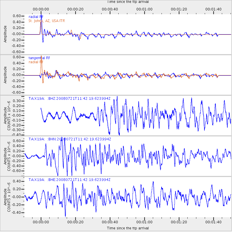
Earthquake location: Off East Coast Of Honshu, Japan
Earthquake latitude/longitude: 37.2/142.1
Earthquake time(UTC): 2008/07/21 (203) 11:30:29 GMT
Earthquake Depth: 22 km
Earthquake Magnitude: 5.7 MB, 5.6 MS, 6.0 MW, 5.9 MW
Earthquake Catalog/Contributor: WHDF/NEIC
Network: TA USArray Transportable Network (new EarthScope stations)
Station: X19A St. Johns, AZ, USA
Lat/Lon: 34.43 N/109.29 W
Elevation: 1861 m
Distance: 82.7 deg
Az: 52.149 deg
Baz: 310.282 deg
Ray Param: 0.046700798
Estimated Moho Depth: 43.25 km
Estimated Crust Vp/Vs: 1.71
Assumed Crust Vp: 6.496 km/s
Estimated Crust Vs: 3.804 km/s
Estimated Crust Poisson's Ratio: 0.24
Radial Match: 80.06554 %
Radial Bump: 347
Transverse Match: 79.29789 %
Transverse Bump: 400
SOD ConfigId: 2504
Insert Time: 2010-03-06 16:09:03.356 +0000
GWidth: 2.5
Max Bumps: 400
Tol: 0.001

Signal To Noise

ChannelStoNSTALTA
TA:X19A: :BHN:20080721T11:42:19.623994Z3.52050661.8092183E-75.1390852E-8
TA:X19A: :BHE:20080721T11:42:19.623994Z3.20810871.3347076E-74.160419E-8
TA:X19A: :BHZ:20080721T11:42:19.623994Z1.31469769.288008E-87.064748E-8
Arrivals
Ps4.8 SECOND
PpPs18 SECOND
PsPs/PpSs22 SECOND