You are here: Home > Network List > TA - USArray Transportable Network (new EarthScope stations) Stations List
> Station I23K Minto, Yukon-Koyukuk, AK, USA > Earthquake Result Viewer
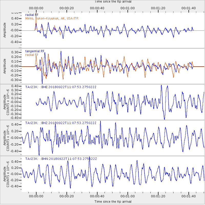
I23K Minto, Yukon-Koyukuk, AK, USA - Earthquake Result Viewer
*The percent match for this event was below the threshold and hence no stack was calculated.
| Earthquake location: |
Ryukyu Islands, Japan |
| Earthquake latitude/longitude: |
26.7/129.6 |
| Earthquake time(UTC): |
2018/09/22 (265) 10:58:01 GMT |
| Earthquake Depth: |
10 km |
| Earthquake Magnitude: |
5.5 Mww |
| Earthquake Catalog/Contributor: |
NEIC PDE/us |
|
| Network: |
TA USArray Transportable Network (new EarthScope stations) |
| Station: |
I23K Minto, Yukon-Koyukuk, AK, USA |
| Lat/Lon: |
65.15 N/149.36 W |
| Elevation: |
149 m |
|
| Distance: |
62.4 deg |
| Az: |
28.107 deg |
| Baz: |
273.991 deg |
| Ray Param: |
$rayparam |
*The percent match for this event was below the threshold and hence was not used in the summary stack. |
|
| Radial Match: |
54.577976 % |
| Radial Bump: |
400 |
| Transverse Match: |
40.623615 % |
| Transverse Bump: |
338 |
| SOD ConfigId: |
13570011 |
| Insert Time: |
2019-05-01 07:47:49.613 +0000 |
| GWidth: |
2.5 |
| Max Bumps: |
400 |
| Tol: |
0.001 |
|
Signal To Noise
| Channel | StoN | STA | LTA |
| TA:I23K: :BHZ:20180922T11:07:53.275022Z | 2.6316276 | 2.2099162E-7 | 8.3975266E-8 |
| TA:I23K: :BHN:20180922T11:07:53.275022Z | 1.1465842 | 1.6147328E-7 | 1.4082987E-7 |
| TA:I23K: :BHE:20180922T11:07:53.275022Z | 1.532514 | 1.3683594E-7 | 8.928854E-8 |
| Arrivals |
| Ps | |
| PpPs | |
| PsPs/PpSs | |


