You are here: Home > Network List > TA - USArray Transportable Network (new EarthScope stations) Stations List
> Station R33M Jennings River, BC, CAN > Earthquake Result Viewer
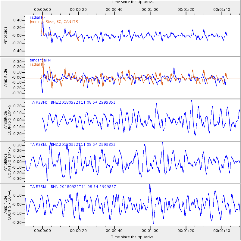
R33M Jennings River, BC, CAN - Earthquake Result Viewer
*The percent match for this event was below the threshold and hence no stack was calculated.
| Earthquake location: |
Ryukyu Islands, Japan |
| Earthquake latitude/longitude: |
26.7/129.6 |
| Earthquake time(UTC): |
2018/09/22 (265) 10:58:01 GMT |
| Earthquake Depth: |
10 km |
| Earthquake Magnitude: |
5.5 Mww |
| Earthquake Catalog/Contributor: |
NEIC PDE/us |
|
| Network: |
TA USArray Transportable Network (new EarthScope stations) |
| Station: |
R33M Jennings River, BC, CAN |
| Lat/Lon: |
59.39 N/130.97 W |
| Elevation: |
1437 m |
|
| Distance: |
72.0 deg |
| Az: |
32.057 deg |
| Baz: |
291.836 deg |
| Ray Param: |
$rayparam |
*The percent match for this event was below the threshold and hence was not used in the summary stack. |
|
| Radial Match: |
65.58671 % |
| Radial Bump: |
400 |
| Transverse Match: |
59.50868 % |
| Transverse Bump: |
400 |
| SOD ConfigId: |
13570011 |
| Insert Time: |
2019-05-01 07:48:25.634 +0000 |
| GWidth: |
2.5 |
| Max Bumps: |
400 |
| Tol: |
0.001 |
|
Signal To Noise
| Channel | StoN | STA | LTA |
| TA:R33M: :BHZ:20180922T11:08:54.299985Z | 2.5355601 | 1.781273E-7 | 7.025165E-8 |
| TA:R33M: :BHN:20180922T11:08:54.299985Z | 1.2656491 | 7.656102E-8 | 6.049151E-8 |
| TA:R33M: :BHE:20180922T11:08:54.299985Z | 1.0489057 | 6.9178085E-8 | 6.595263E-8 |
| Arrivals |
| Ps | |
| PpPs | |
| PsPs/PpSs | |


