You are here: Home > Network List > UW - Pacific Northwest Regional Seismic Network Stations List
> Station UMAT Pilot Rock, OR, USA > Earthquake Result Viewer
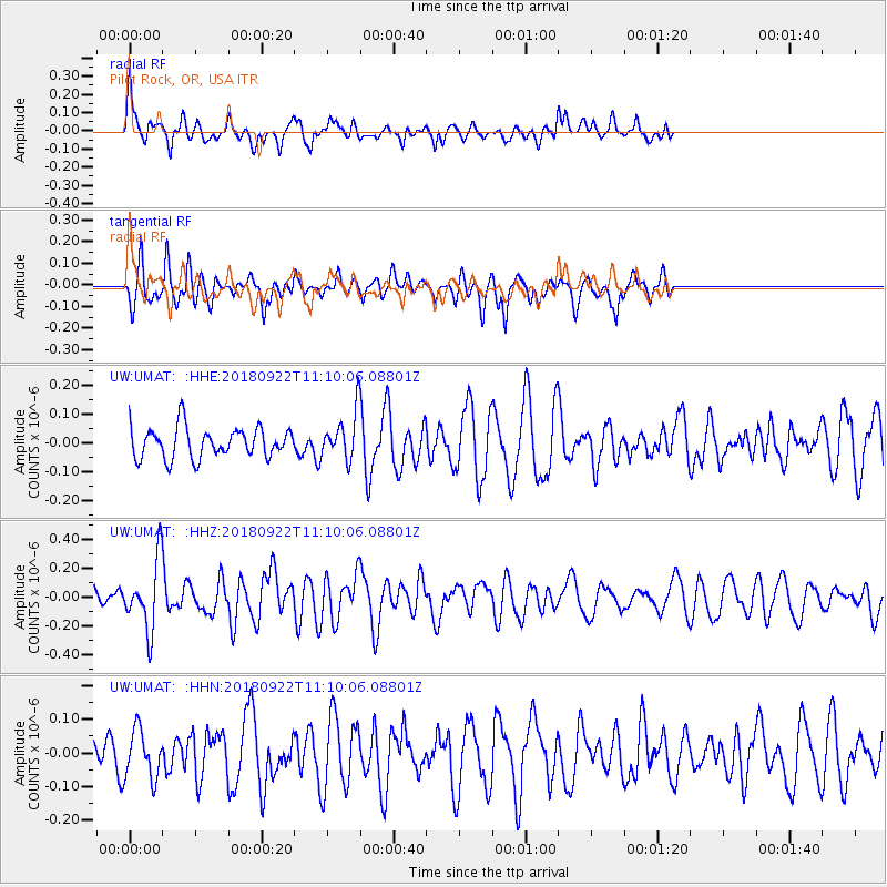
UMAT Pilot Rock, OR, USA - Earthquake Result Viewer
*The percent match for this event was below the threshold and hence no stack was calculated.
| Earthquake location: |
Ryukyu Islands, Japan |
| Earthquake latitude/longitude: |
26.7/129.6 |
| Earthquake time(UTC): |
2018/09/22 (265) 10:58:01 GMT |
| Earthquake Depth: |
10 km |
| Earthquake Magnitude: |
5.5 Mww |
| Earthquake Catalog/Contributor: |
NEIC PDE/us |
|
| Network: |
UW Pacific Northwest Regional Seismic Network |
| Station: |
UMAT Pilot Rock, OR, USA |
| Lat/Lon: |
45.29 N/118.96 W |
| Elevation: |
1318 m |
|
| Distance: |
85.1 deg |
| Az: |
41.276 deg |
| Baz: |
303.251 deg |
| Ray Param: |
$rayparam |
*The percent match for this event was below the threshold and hence was not used in the summary stack. |
|
| Radial Match: |
57.616013 % |
| Radial Bump: |
353 |
| Transverse Match: |
66.03623 % |
| Transverse Bump: |
400 |
| SOD ConfigId: |
13570011 |
| Insert Time: |
2019-05-01 07:49:12.139 +0000 |
| GWidth: |
2.5 |
| Max Bumps: |
400 |
| Tol: |
0.001 |
|
Signal To Noise
| Channel | StoN | STA | LTA |
| UW:UMAT: :HHZ:20180922T11:10:06.08801Z | 2.7884424 | 2.3120901E-7 | 8.2916905E-8 |
| UW:UMAT: :HHN:20180922T11:10:06.08801Z | 1.109705 | 7.3003896E-8 | 6.5786764E-8 |
| UW:UMAT: :HHE:20180922T11:10:06.08801Z | 1.50601 | 7.9471164E-8 | 5.2769344E-8 |
| Arrivals |
| Ps | |
| PpPs | |
| PsPs/PpSs | |


