X19A St. Johns, AZ, USA - Earthquake Result Viewer
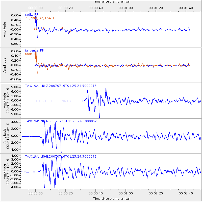
Earthquake location: Near West Coast Of Honshu, Japan
Earthquake latitude/longitude: 37.5/138.4
Earthquake time(UTC): 2007/07/16 (197) 01:13:22 GMT
Earthquake Depth: 12 km
Earthquake Magnitude: 6.5 MB, 6.4 MS, 6.6 MW, 6.5 MW
Earthquake Catalog/Contributor: WHDF/NEIC
Network: TA USArray Transportable Network (new EarthScope stations)
Station: X19A St. Johns, AZ, USA
Lat/Lon: 34.43 N/109.29 W
Elevation: 1861 m
Distance: 84.7 deg
Az: 50.199 deg
Baz: 312.366 deg
Ray Param: 0.045294974
Estimated Moho Depth: 45.75 km
Estimated Crust Vp/Vs: 1.60
Assumed Crust Vp: 6.496 km/s
Estimated Crust Vs: 4.054 km/s
Estimated Crust Poisson's Ratio: 0.18
Radial Match: 97.88982 %
Radial Bump: 271
Transverse Match: 91.40694 %
Transverse Bump: 400
SOD ConfigId: 2564
Insert Time: 2010-03-06 16:10:56.746 +0000
GWidth: 2.5
Max Bumps: 400
Tol: 0.001

Signal To Noise

ChannelStoNSTALTA
TA:X19A: :BHN:20070716T01:25:24.500005Z12.9981415.7868425E-74.4520537E-8
TA:X19A: :BHE:20070716T01:25:24.500005Z14.2512835.87956E-74.1256357E-8
TA:X19A: :BHZ:20070716T01:25:24.500005Z55.006272.2614252E-64.111213E-8
Arrivals
Ps4.4 SECOND
PpPs18 SECOND
PsPs/PpSs22 SECOND