You are here: Home > Network List > TA - USArray Transportable Network (new EarthScope stations) Stations List
> Station X19A St. Johns, AZ, USA > Earthquake Result Viewer
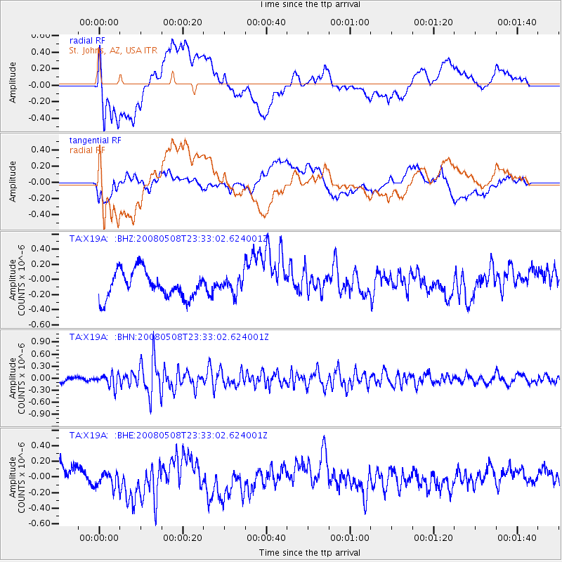
X19A St. Johns, AZ, USA - Earthquake Result Viewer
*The percent match for this event was below the threshold and hence no stack was calculated.
| Earthquake location: |
Near East Coast Of Honshu, Japan |
| Earthquake latitude/longitude: |
36.1/141.7 |
| Earthquake time(UTC): |
2008/05/08 (129) 23:21:06 GMT |
| Earthquake Depth: |
17 km |
| Earthquake Magnitude: |
5.6 MB, 5.2 MS, 5.6 MW, 5.5 MW |
| Earthquake Catalog/Contributor: |
WHDF/NEIC |
|
| Network: |
TA USArray Transportable Network (new EarthScope stations) |
| Station: |
X19A St. Johns, AZ, USA |
| Lat/Lon: |
34.43 N/109.29 W |
| Elevation: |
1861 m |
|
| Distance: |
83.6 deg |
| Az: |
51.85 deg |
| Baz: |
309.611 deg |
| Ray Param: |
$rayparam |
*The percent match for this event was below the threshold and hence was not used in the summary stack. |
|
| Radial Match: |
58.53283 % |
| Radial Bump: |
400 |
| Transverse Match: |
40.097473 % |
| Transverse Bump: |
400 |
| SOD ConfigId: |
2504 |
| Insert Time: |
2010-03-06 16:11:42.754 +0000 |
| GWidth: |
2.5 |
| Max Bumps: |
400 |
| Tol: |
0.001 |
|
Signal To Noise
| Channel | StoN | STA | LTA |
| TA:X19A: :BHN:20080508T23:33:02.624001Z | 2.2388659 | 1.6633028E-7 | 7.42922E-8 |
| TA:X19A: :BHE:20080508T23:33:02.624001Z | 0.35309738 | 9.941509E-8 | 2.8155148E-7 |
| TA:X19A: :BHZ:20080508T23:33:02.624001Z | 0.64852583 | 1.1324368E-7 | 1.7461707E-7 |
| Arrivals |
| Ps | |
| PpPs | |
| PsPs/PpSs | |


