You are here: Home > Network List > TA - USArray Transportable Network (new EarthScope stations) Stations List
> Station X19A St. Johns, AZ, USA > Earthquake Result Viewer
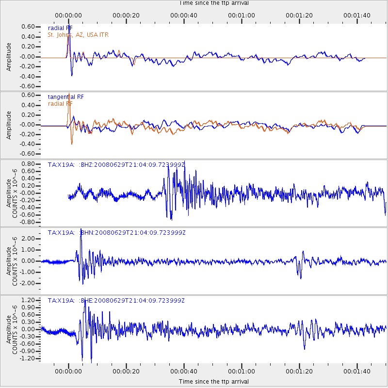
X19A St. Johns, AZ, USA - Earthquake Result Viewer
*The percent match for this event was below the threshold and hence no stack was calculated.
| Earthquake location: |
Primor'ye, Russia |
| Earthquake latitude/longitude: |
45.2/137.4 |
| Earthquake time(UTC): |
2008/06/29 (181) 20:53:01 GMT |
| Earthquake Depth: |
287 km |
| Earthquake Magnitude: |
5.6 MB, 6.0 MW, 5.9 MW |
| Earthquake Catalog/Contributor: |
WHDF/NEIC |
|
| Network: |
TA USArray Transportable Network (new EarthScope stations) |
| Station: |
X19A St. Johns, AZ, USA |
| Lat/Lon: |
34.43 N/109.29 W |
| Elevation: |
1861 m |
|
| Distance: |
80.4 deg |
| Az: |
50.355 deg |
| Baz: |
318.772 deg |
| Ray Param: |
$rayparam |
*The percent match for this event was below the threshold and hence was not used in the summary stack. |
|
| Radial Match: |
77.047264 % |
| Radial Bump: |
400 |
| Transverse Match: |
49.584805 % |
| Transverse Bump: |
400 |
| SOD ConfigId: |
2504 |
| Insert Time: |
2010-03-06 16:11:45.527 +0000 |
| GWidth: |
2.5 |
| Max Bumps: |
400 |
| Tol: |
0.001 |
|
Signal To Noise
| Channel | StoN | STA | LTA |
| TA:X19A: :BHN:20080629T21:04:09.723999Z | 6.961117 | 8.4033246E-7 | 1.2071806E-7 |
| TA:X19A: :BHE:20080629T21:04:09.723999Z | 3.1409664 | 3.5065736E-7 | 1.11639956E-7 |
| TA:X19A: :BHZ:20080629T21:04:09.723999Z | 3.1213536 | 2.6925753E-7 | 8.626306E-8 |
| Arrivals |
| Ps | |
| PpPs | |
| PsPs/PpSs | |


