You are here: Home > Network List > CI - Caltech Regional Seismic Network Stations List
> Station GLA Glamis, Glamis, CA, USA > Earthquake Result Viewer
GLA Glamis, Glamis, CA, USA - Earthquake Result Viewer
*The percent match for this event was below the threshold and hence no stack was calculated.
| Earthquake location: |
South Of Mariana Islands |
| Earthquake latitude/longitude: |
12.2/146.2 |
| Earthquake time(UTC): |
2018/09/23 (266) 05:52:11 GMT |
| Earthquake Depth: |
10 km |
| Earthquake Magnitude: |
5.9 Mww |
| Earthquake Catalog/Contributor: |
NEIC PDE/us |
|
| Network: |
CI Caltech Regional Seismic Network |
| Station: |
GLA Glamis, Glamis, CA, USA |
| Lat/Lon: |
33.05 N/114.83 W |
| Elevation: |
610 m |
|
| Distance: |
90.8 deg |
| Az: |
56.072 deg |
| Baz: |
285.009 deg |
| Ray Param: |
$rayparam |
*The percent match for this event was below the threshold and hence was not used in the summary stack. |
|
| Radial Match: |
70.400826 % |
| Radial Bump: |
400 |
| Transverse Match: |
66.754295 % |
| Transverse Bump: |
400 |
| SOD ConfigId: |
13570011 |
| Insert Time: |
2019-05-01 08:01:39.582 +0000 |
| GWidth: |
2.5 |
| Max Bumps: |
400 |
| Tol: |
0.001 |
|
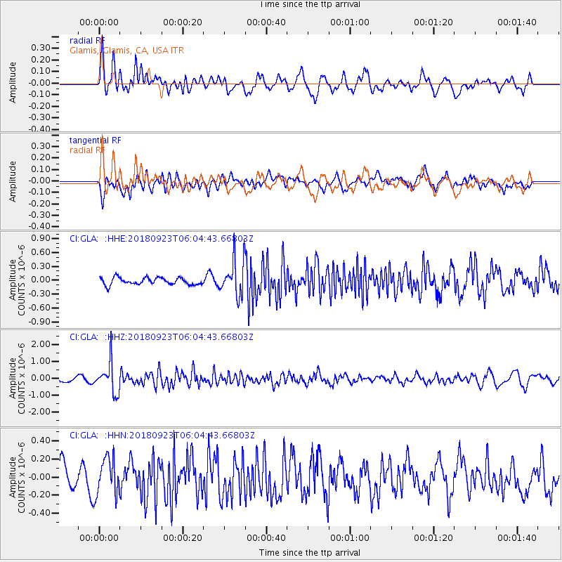
Signal To Noise
| Channel | StoN | STA | LTA |
| CI:GLA: :HHZ:20180923T06:04:43.66803Z | 6.936695 | 9.224664E-7 | 1.3298356E-7 |
| CI:GLA: :HHN:20180923T06:04:43.66803Z | 0.91956633 | 2.031029E-7 | 2.2086812E-7 |
| CI:GLA: :HHE:20180923T06:04:43.66803Z | 4.435402 | 3.3706323E-7 | 7.5993846E-8 |
| Arrivals |
| Ps | |
| PpPs | |
| PsPs/PpSs | |


