You are here: Home > Network List > CN - Canadian National Seismograph Network Stations List
> Station INK INUVIK, NT > Earthquake Result Viewer
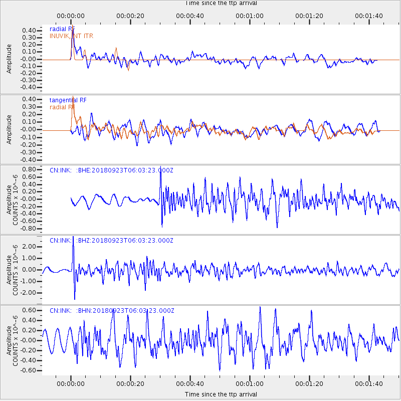
INK INUVIK, NT - Earthquake Result Viewer
*The percent match for this event was below the threshold and hence no stack was calculated.
| Earthquake location: |
South Of Mariana Islands |
| Earthquake latitude/longitude: |
12.2/146.2 |
| Earthquake time(UTC): |
2018/09/23 (266) 05:52:11 GMT |
| Earthquake Depth: |
10 km |
| Earthquake Magnitude: |
5.9 Mww |
| Earthquake Catalog/Contributor: |
NEIC PDE/us |
|
| Network: |
CN Canadian National Seismograph Network |
| Station: |
INK INUVIK, NT |
| Lat/Lon: |
68.31 N/133.53 W |
| Elevation: |
44 m |
|
| Distance: |
75.1 deg |
| Az: |
22.279 deg |
| Baz: |
265.5 deg |
| Ray Param: |
$rayparam |
*The percent match for this event was below the threshold and hence was not used in the summary stack. |
|
| Radial Match: |
68.60078 % |
| Radial Bump: |
400 |
| Transverse Match: |
59.305897 % |
| Transverse Bump: |
400 |
| SOD ConfigId: |
13570011 |
| Insert Time: |
2019-05-01 08:02:22.519 +0000 |
| GWidth: |
2.5 |
| Max Bumps: |
400 |
| Tol: |
0.001 |
|
Signal To Noise
| Channel | StoN | STA | LTA |
| CN:INK: :BHZ:20180923T06:03:23.000Z | 4.7988987 | 9.175172E-7 | 1.9119327E-7 |
| CN:INK: :BHN:20180923T06:03:23.000Z | 1.3475087 | 2.148448E-7 | 1.5943853E-7 |
| CN:INK: :BHE:20180923T06:03:23.000Z | 3.2471576 | 3.1120524E-7 | 9.5839276E-8 |
| Arrivals |
| Ps | |
| PpPs | |
| PsPs/PpSs | |


