You are here: Home > Network List > TA - USArray Transportable Network (new EarthScope stations) Stations List
> Station X19A St. Johns, AZ, USA > Earthquake Result Viewer
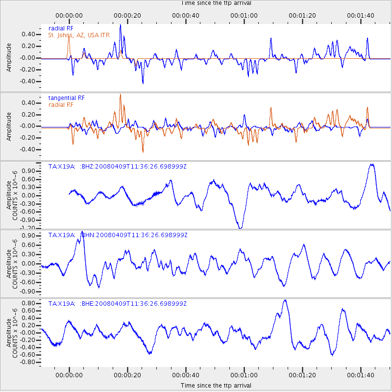
X19A St. Johns, AZ, USA - Earthquake Result Viewer
*The percent match for this event was below the threshold and hence no stack was calculated.
| Earthquake location: |
Loyalty Islands |
| Earthquake latitude/longitude: |
-20.2/168.9 |
| Earthquake time(UTC): |
2008/04/09 (100) 11:23:40 GMT |
| Earthquake Depth: |
35 km |
| Earthquake Magnitude: |
5.7 MB, 6.3 MW, 6.3 MW |
| Earthquake Catalog/Contributor: |
WHDF/NEIC |
|
| Network: |
TA USArray Transportable Network (new EarthScope stations) |
| Station: |
X19A St. Johns, AZ, USA |
| Lat/Lon: |
34.43 N/109.29 W |
| Elevation: |
1861 m |
|
| Distance: |
94.7 deg |
| Az: |
55.181 deg |
| Baz: |
248.893 deg |
| Ray Param: |
$rayparam |
*The percent match for this event was below the threshold and hence was not used in the summary stack. |
|
| Radial Match: |
74.011734 % |
| Radial Bump: |
400 |
| Transverse Match: |
69.661995 % |
| Transverse Bump: |
400 |
| SOD ConfigId: |
2504 |
| Insert Time: |
2010-03-06 16:12:18.184 +0000 |
| GWidth: |
2.5 |
| Max Bumps: |
400 |
| Tol: |
0.001 |
|
Signal To Noise
| Channel | StoN | STA | LTA |
| TA:X19A: :BHN:20080409T11:36:26.698999Z | 3.389738 | 5.883023E-7 | 1.7355393E-7 |
| TA:X19A: :BHE:20080409T11:36:26.698999Z | 1.4805962 | 1.9236941E-7 | 1.29927E-7 |
| TA:X19A: :BHZ:20080409T11:36:26.698999Z | 1.6378957 | 2.9623865E-7 | 1.8086538E-7 |
| Arrivals |
| Ps | |
| PpPs | |
| PsPs/PpSs | |


