You are here: Home > Network List > TA - USArray Transportable Network (new EarthScope stations) Stations List
> Station X19A St. Johns, AZ, USA > Earthquake Result Viewer
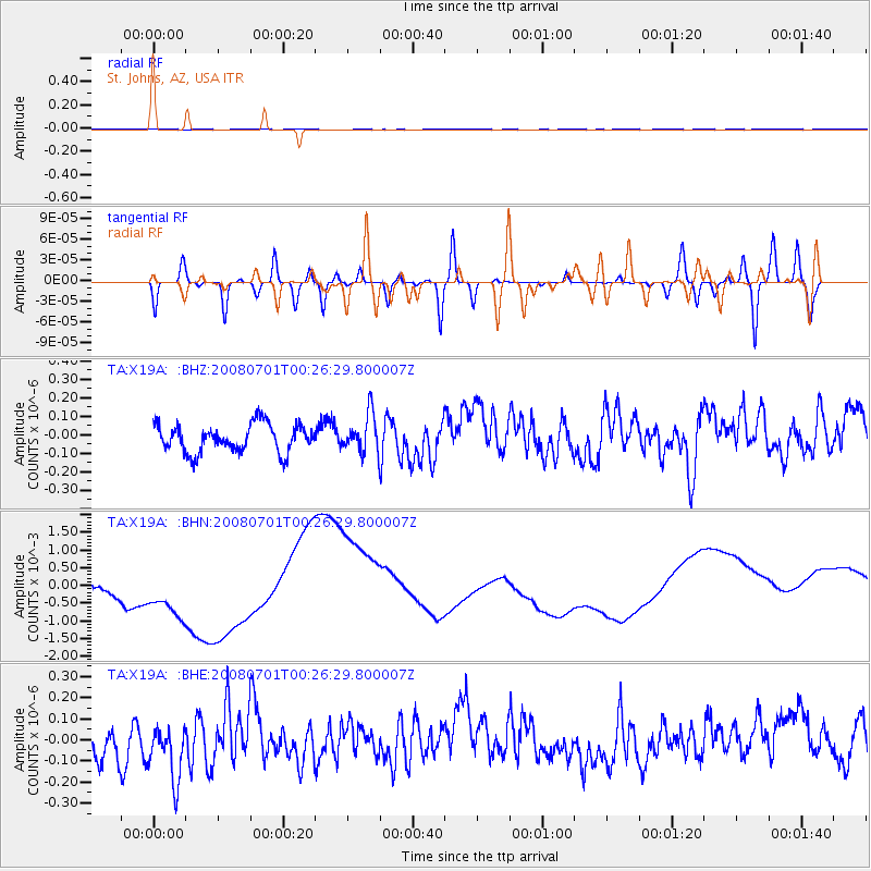
X19A St. Johns, AZ, USA - Earthquake Result Viewer
*The percent match for this event was below the threshold and hence no stack was calculated.
| Earthquake location: |
Central Peru |
| Earthquake latitude/longitude: |
-10.4/-75.5 |
| Earthquake time(UTC): |
2008/07/01 (183) 00:17:33 GMT |
| Earthquake Depth: |
33 km |
| Earthquake Magnitude: |
5.5 MW, 5.0 MS, 5.4 MB, 5.3 ML |
| Earthquake Catalog/Contributor: |
WHDF/NEIC |
|
| Network: |
TA USArray Transportable Network (new EarthScope stations) |
| Station: |
X19A St. Johns, AZ, USA |
| Lat/Lon: |
34.43 N/109.29 W |
| Elevation: |
1861 m |
|
| Distance: |
54.9 deg |
| Az: |
325.812 deg |
| Baz: |
138.024 deg |
| Ray Param: |
$rayparam |
*The percent match for this event was below the threshold and hence was not used in the summary stack. |
|
| Radial Match: |
35.948013 % |
| Radial Bump: |
400 |
| Transverse Match: |
32.64992 % |
| Transverse Bump: |
400 |
| SOD ConfigId: |
2504 |
| Insert Time: |
2010-03-06 16:12:26.121 +0000 |
| GWidth: |
2.5 |
| Max Bumps: |
400 |
| Tol: |
0.001 |
|
Signal To Noise
| Channel | StoN | STA | LTA |
| TA:X19A: :BHN:20080701T00:26:29.800007Z | 1.4860175 | 0.0011516545 | 7.749939E-4 |
| TA:X19A: :BHE:20080701T00:26:29.800007Z | 1.7140402 | 1.5611982E-7 | 9.1082946E-8 |
| TA:X19A: :BHZ:20080701T00:26:29.800007Z | 1.3996702 | 1.0483349E-7 | 7.489871E-8 |
| Arrivals |
| Ps | |
| PpPs | |
| PsPs/PpSs | |


