You are here: Home > Network List > TA - USArray Transportable Network (new EarthScope stations) Stations List
> Station B18K Kokolik River, AK, USA > Earthquake Result Viewer
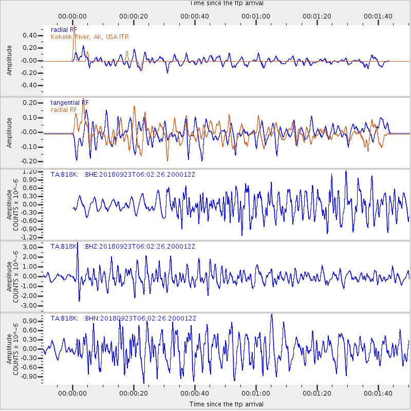
B18K Kokolik River, AK, USA - Earthquake Result Viewer
*The percent match for this event was below the threshold and hence no stack was calculated.
| Earthquake location: |
South Of Mariana Islands |
| Earthquake latitude/longitude: |
12.2/146.2 |
| Earthquake time(UTC): |
2018/09/23 (266) 05:52:11 GMT |
| Earthquake Depth: |
10 km |
| Earthquake Magnitude: |
5.9 Mww |
| Earthquake Catalog/Contributor: |
NEIC PDE/us |
|
| Network: |
TA USArray Transportable Network (new EarthScope stations) |
| Station: |
B18K Kokolik River, AK, USA |
| Lat/Lon: |
69.36 N/161.80 W |
| Elevation: |
222 m |
|
| Distance: |
65.8 deg |
| Az: |
17.826 deg |
| Baz: |
237.588 deg |
| Ray Param: |
$rayparam |
*The percent match for this event was below the threshold and hence was not used in the summary stack. |
|
| Radial Match: |
76.420906 % |
| Radial Bump: |
400 |
| Transverse Match: |
64.49725 % |
| Transverse Bump: |
400 |
| SOD ConfigId: |
13570011 |
| Insert Time: |
2019-05-01 08:05:55.292 +0000 |
| GWidth: |
2.5 |
| Max Bumps: |
400 |
| Tol: |
0.001 |
|
Signal To Noise
| Channel | StoN | STA | LTA |
| TA:B18K: :BHZ:20180923T06:02:26.200012Z | 4.2813697 | 1.0678591E-6 | 2.4941997E-7 |
| TA:B18K: :BHN:20180923T06:02:26.200012Z | 1.0233654 | 2.1813698E-7 | 2.131565E-7 |
| TA:B18K: :BHE:20180923T06:02:26.200012Z | 1.8149155 | 3.3974428E-7 | 1.8719564E-7 |
| Arrivals |
| Ps | |
| PpPs | |
| PsPs/PpSs | |


