You are here: Home > Network List > TA - USArray Transportable Network (new EarthScope stations) Stations List
> Station H31M Peel River, Yukon, CAN > Earthquake Result Viewer
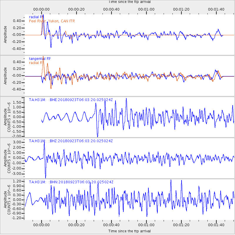
H31M Peel River, Yukon, CAN - Earthquake Result Viewer
*The percent match for this event was below the threshold and hence no stack was calculated.
| Earthquake location: |
South Of Mariana Islands |
| Earthquake latitude/longitude: |
12.2/146.2 |
| Earthquake time(UTC): |
2018/09/23 (266) 05:52:11 GMT |
| Earthquake Depth: |
10 km |
| Earthquake Magnitude: |
5.9 Mww |
| Earthquake Catalog/Contributor: |
NEIC PDE/us |
|
| Network: |
TA USArray Transportable Network (new EarthScope stations) |
| Station: |
H31M Peel River, Yukon, CAN |
| Lat/Lon: |
65.81 N/134.34 W |
| Elevation: |
642 m |
|
| Distance: |
74.6 deg |
| Az: |
24.848 deg |
| Baz: |
265.42 deg |
| Ray Param: |
$rayparam |
*The percent match for this event was below the threshold and hence was not used in the summary stack. |
|
| Radial Match: |
79.34594 % |
| Radial Bump: |
400 |
| Transverse Match: |
70.54938 % |
| Transverse Bump: |
400 |
| SOD ConfigId: |
13570011 |
| Insert Time: |
2019-05-01 08:06:50.271 +0000 |
| GWidth: |
2.5 |
| Max Bumps: |
400 |
| Tol: |
0.001 |
|
Signal To Noise
| Channel | StoN | STA | LTA |
| TA:H31M: :BHZ:20180923T06:03:20.025024Z | 6.4174705 | 1.3473843E-6 | 2.0995567E-7 |
| TA:H31M: :BHN:20180923T06:03:20.025024Z | 0.6961228 | 2.1807634E-7 | 3.1327278E-7 |
| TA:H31M: :BHE:20180923T06:03:20.025024Z | 3.069207 | 8.790577E-7 | 2.8641202E-7 |
| Arrivals |
| Ps | |
| PpPs | |
| PsPs/PpSs | |


