You are here: Home > Network List > TA - USArray Transportable Network (new EarthScope stations) Stations List
> Station 121A Cookes Peak, Deming, NM, USA > Earthquake Result Viewer
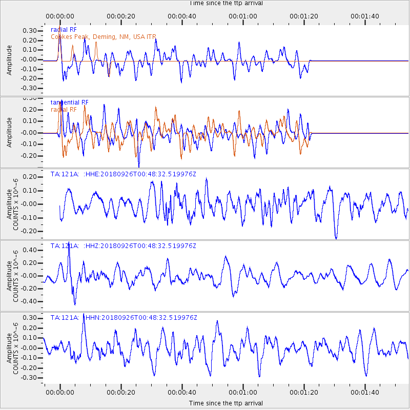
121A Cookes Peak, Deming, NM, USA - Earthquake Result Viewer
*The percent match for this event was below the threshold and hence no stack was calculated.
| Earthquake location: |
Fiji Islands Region |
| Earthquake latitude/longitude: |
-18.0/-178.1 |
| Earthquake time(UTC): |
2018/09/26 (269) 00:37:33 GMT |
| Earthquake Depth: |
569 km |
| Earthquake Magnitude: |
5.8 Mwb |
| Earthquake Catalog/Contributor: |
NEIC PDE/us |
|
| Network: |
TA USArray Transportable Network (new EarthScope stations) |
| Station: |
121A Cookes Peak, Deming, NM, USA |
| Lat/Lon: |
32.53 N/107.79 W |
| Elevation: |
1652 m |
|
| Distance: |
83.9 deg |
| Az: |
53.12 deg |
| Baz: |
244.3 deg |
| Ray Param: |
$rayparam |
*The percent match for this event was below the threshold and hence was not used in the summary stack. |
|
| Radial Match: |
67.22265 % |
| Radial Bump: |
400 |
| Transverse Match: |
60.153736 % |
| Transverse Bump: |
400 |
| SOD ConfigId: |
13570011 |
| Insert Time: |
2019-05-01 08:15:37.406 +0000 |
| GWidth: |
2.5 |
| Max Bumps: |
400 |
| Tol: |
0.001 |
|
Signal To Noise
| Channel | StoN | STA | LTA |
| TA:121A: :HHZ:20180926T00:48:32.519976Z | 2.2742417 | 2.0786213E-7 | 9.1398434E-8 |
| TA:121A: :HHN:20180926T00:48:32.519976Z | 0.53188884 | 5.1254275E-8 | 9.636275E-8 |
| TA:121A: :HHE:20180926T00:48:32.519976Z | 1.804524 | 1.0521374E-7 | 5.830554E-8 |
| Arrivals |
| Ps | |
| PpPs | |
| PsPs/PpSs | |


