You are here: Home > Network List > TA - USArray Transportable Network (new EarthScope stations) Stations List
> Station E18K Tukpahlearik Creek, AK, USA > Earthquake Result Viewer
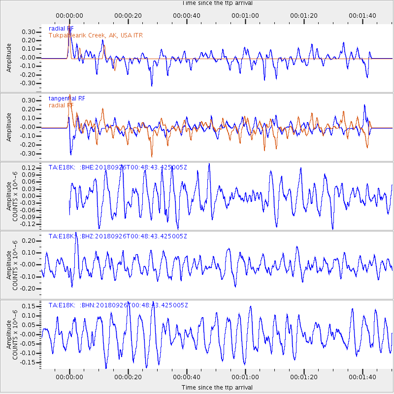
E18K Tukpahlearik Creek, AK, USA - Earthquake Result Viewer
*The percent match for this event was below the threshold and hence no stack was calculated.
| Earthquake location: |
Fiji Islands Region |
| Earthquake latitude/longitude: |
-18.0/-178.1 |
| Earthquake time(UTC): |
2018/09/26 (269) 00:37:33 GMT |
| Earthquake Depth: |
569 km |
| Earthquake Magnitude: |
5.8 Mwb |
| Earthquake Catalog/Contributor: |
NEIC PDE/us |
|
| Network: |
TA USArray Transportable Network (new EarthScope stations) |
| Station: |
E18K Tukpahlearik Creek, AK, USA |
| Lat/Lon: |
67.42 N/160.60 W |
| Elevation: |
297 m |
|
| Distance: |
86.2 deg |
| Az: |
6.684 deg |
| Baz: |
196.668 deg |
| Ray Param: |
$rayparam |
*The percent match for this event was below the threshold and hence was not used in the summary stack. |
|
| Radial Match: |
46.806427 % |
| Radial Bump: |
385 |
| Transverse Match: |
58.144196 % |
| Transverse Bump: |
400 |
| SOD ConfigId: |
13570011 |
| Insert Time: |
2019-05-01 08:15:42.238 +0000 |
| GWidth: |
2.5 |
| Max Bumps: |
400 |
| Tol: |
0.001 |
|
Signal To Noise
| Channel | StoN | STA | LTA |
| TA:E18K: :BHZ:20180926T00:48:43.425005Z | 2.6339417 | 1.2129132E-7 | 4.604936E-8 |
| TA:E18K: :BHN:20180926T00:48:43.425005Z | 0.644031 | 5.249127E-8 | 8.150426E-8 |
| TA:E18K: :BHE:20180926T00:48:43.425005Z | 1.0895517 | 6.426299E-8 | 5.898113E-8 |
| Arrivals |
| Ps | |
| PpPs | |
| PsPs/PpSs | |


