You are here: Home > Network List > TA - USArray Transportable Network (new EarthScope stations) Stations List
> Station J20K Nowitna River, AK, USA > Earthquake Result Viewer
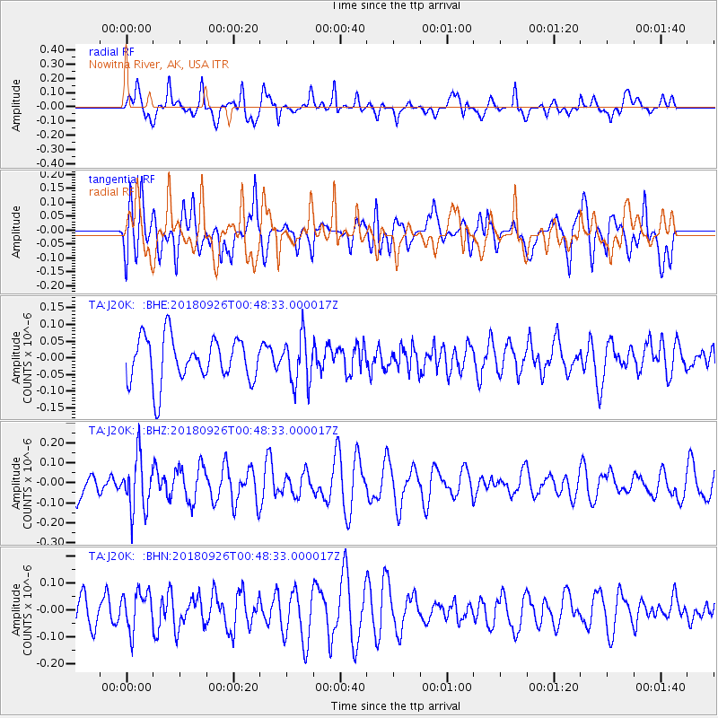
J20K Nowitna River, AK, USA - Earthquake Result Viewer
*The percent match for this event was below the threshold and hence no stack was calculated.
| Earthquake location: |
Fiji Islands Region |
| Earthquake latitude/longitude: |
-18.0/-178.1 |
| Earthquake time(UTC): |
2018/09/26 (269) 00:37:33 GMT |
| Earthquake Depth: |
569 km |
| Earthquake Magnitude: |
5.8 Mwb |
| Earthquake Catalog/Contributor: |
NEIC PDE/us |
|
| Network: |
TA USArray Transportable Network (new EarthScope stations) |
| Station: |
J20K Nowitna River, AK, USA |
| Lat/Lon: |
64.18 N/154.15 W |
| Elevation: |
314 m |
|
| Distance: |
84.0 deg |
| Az: |
10.302 deg |
| Baz: |
202.863 deg |
| Ray Param: |
$rayparam |
*The percent match for this event was below the threshold and hence was not used in the summary stack. |
|
| Radial Match: |
46.173054 % |
| Radial Bump: |
400 |
| Transverse Match: |
50.347614 % |
| Transverse Bump: |
400 |
| SOD ConfigId: |
13570011 |
| Insert Time: |
2019-05-01 08:15:56.820 +0000 |
| GWidth: |
2.5 |
| Max Bumps: |
400 |
| Tol: |
0.001 |
|
Signal To Noise
| Channel | StoN | STA | LTA |
| TA:J20K: :BHZ:20180926T00:48:33.000017Z | 2.5197866 | 1.345574E-7 | 5.340031E-8 |
| TA:J20K: :BHN:20180926T00:48:33.000017Z | 0.86150753 | 7.2902246E-8 | 8.462172E-8 |
| TA:J20K: :BHE:20180926T00:48:33.000017Z | 1.0594451 | 7.052E-8 | 6.6563146E-8 |
| Arrivals |
| Ps | |
| PpPs | |
| PsPs/PpSs | |


