You are here: Home > Network List > TA - USArray Transportable Network (new EarthScope stations) Stations List
> Station O18K Koktuh Hills, AK, USA > Earthquake Result Viewer
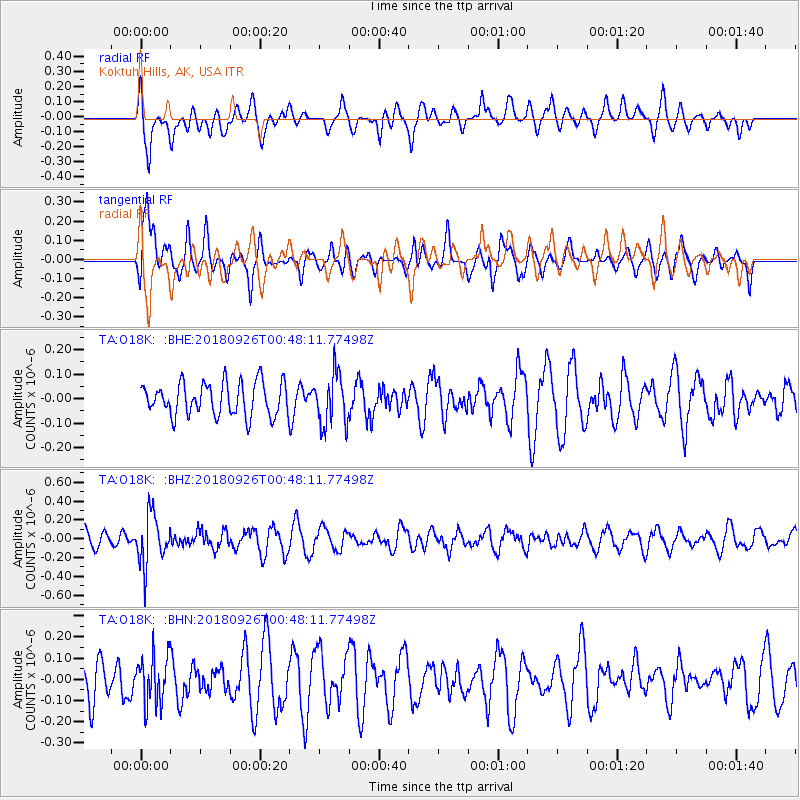
O18K Koktuh Hills, AK, USA - Earthquake Result Viewer
*The percent match for this event was below the threshold and hence no stack was calculated.
| Earthquake location: |
Fiji Islands Region |
| Earthquake latitude/longitude: |
-18.0/-178.1 |
| Earthquake time(UTC): |
2018/09/26 (269) 00:37:33 GMT |
| Earthquake Depth: |
569 km |
| Earthquake Magnitude: |
5.8 Mwb |
| Earthquake Catalog/Contributor: |
NEIC PDE/us |
|
| Network: |
TA USArray Transportable Network (new EarthScope stations) |
| Station: |
O18K Koktuh Hills, AK, USA |
| Lat/Lon: |
59.85 N/155.21 W |
| Elevation: |
544 m |
|
| Distance: |
79.8 deg |
| Az: |
11.51 deg |
| Baz: |
202.097 deg |
| Ray Param: |
$rayparam |
*The percent match for this event was below the threshold and hence was not used in the summary stack. |
|
| Radial Match: |
48.71961 % |
| Radial Bump: |
400 |
| Transverse Match: |
66.33085 % |
| Transverse Bump: |
400 |
| SOD ConfigId: |
13570011 |
| Insert Time: |
2019-05-01 08:16:16.812 +0000 |
| GWidth: |
2.5 |
| Max Bumps: |
400 |
| Tol: |
0.001 |
|
Signal To Noise
| Channel | StoN | STA | LTA |
| TA:O18K: :BHZ:20180926T00:48:11.77498Z | 2.8089447 | 2.632501E-7 | 9.37185E-8 |
| TA:O18K: :BHN:20180926T00:48:11.77498Z | 1.2400498 | 1.1415637E-7 | 9.205789E-8 |
| TA:O18K: :BHE:20180926T00:48:11.77498Z | 1.5894748 | 1.06592836E-7 | 6.706168E-8 |
| Arrivals |
| Ps | |
| PpPs | |
| PsPs/PpSs | |


