You are here: Home > Network List > IU - Global Seismograph Network (GSN - IRIS/USGS) Stations List
> Station CTAO Charters Towers, Australia > Earthquake Result Viewer
CTAO Charters Towers, Australia - Earthquake Result Viewer
*The percent match for this event was below the threshold and hence no stack was calculated.
| Earthquake location: |
Fiji Islands Region |
| Earthquake latitude/longitude: |
-21.0/-178.7 |
| Earthquake time(UTC): |
2009/11/12 (316) 02:13:37 GMT |
| Earthquake Depth: |
571 km |
| Earthquake Magnitude: |
5.8 MW, 5.2 MB, 5.8 MW |
| Earthquake Catalog/Contributor: |
WHDF/NEIC |
|
| Network: |
IU Global Seismograph Network (GSN - IRIS/USGS) |
| Station: |
CTAO Charters Towers, Australia |
| Lat/Lon: |
20.09 S/146.25 E |
| Elevation: |
357 m |
|
| Distance: |
32.8 deg |
| Az: |
265.205 deg |
| Baz: |
97.786 deg |
| Ray Param: |
$rayparam |
*The percent match for this event was below the threshold and hence was not used in the summary stack. |
|
| Radial Match: |
75.48238 % |
| Radial Bump: |
291 |
| Transverse Match: |
66.38677 % |
| Transverse Bump: |
400 |
| SOD ConfigId: |
1 |
| Insert Time: |
2010-02-19 01:10:43.119 +0000 |
| GWidth: |
2.5 |
| Max Bumps: |
400 |
| Tol: |
0.001 |
|
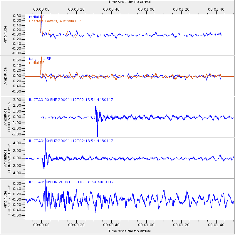
Signal To Noise
| Channel | StoN | STA | LTA |
| IU:CTAO:00:BHZ:20091112T02:18:54.448011Z | 7.814163 | 1.438307E-6 | 1.840641E-7 |
| IU:CTAO:00:BHN:20091112T02:18:54.448011Z | 1.840056 | 2.2842579E-7 | 1.2414067E-7 |
| IU:CTAO:00:BHE:20091112T02:18:54.448011Z | 7.98841 | 9.3494924E-7 | 1.1703822E-7 |
| Arrivals |
| Ps | |
| PpPs | |
| PsPs/PpSs | |


