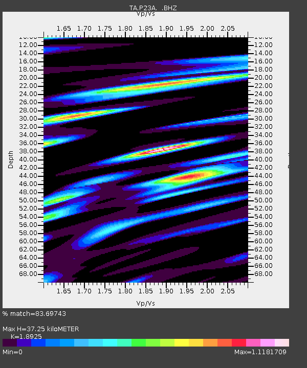
P23A Jefferson, CO, USA - Earthquake Result Viewer

Earthquake location: Andreanof Islands, Aleutian Is.
Earthquake latitude/longitude: 52.2/-175.7
Earthquake time(UTC): 2008/08/07 (220) 18:30:03 GMT
Earthquake Depth: 12 km
Earthquake Magnitude: 5.6 MB, 5.5 MS, 5.8 MW, 5.8 MW
Earthquake Catalog/Contributor: WHDF/NEIC
Network: TA USArray Transportable Network (new EarthScope stations)
Station: P23A Jefferson, CO, USA
Lat/Lon: 39.37 N/105.84 W
Elevation: 3006 m
Distance: 48.5 deg
Az: 76.238 deg
Baz: 309.517 deg
Ray Param: 0.069313675
Estimated Moho Depth: 37.25 km
Estimated Crust Vp/Vs: 1.89
Assumed Crust Vp: 6.159 km/s
Estimated Crust Vs: 3.254 km/s
Estimated Crust Poisson's Ratio: 0.31
Radial Match: 83.69743 %
Radial Bump: 400
Transverse Match: 73.21528 %
Transverse Bump: 400
SOD ConfigId: 2504
Insert Time: 2010-03-06 16:16:20.729 +0000
GWidth: 2.5
Max Bumps: 400
Tol: 0.001

Signal To Noise

ChannelStoNSTALTA
TA:P23A: :BHZ:20080807T18:38:14.700005Z4.72131352.6624733E-75.6392636E-8
TA:P23A: :BHN:20080807T18:38:14.700005Z0.83100479.893624E-81.19056175E-7
TA:P23A: :BHE:20080807T18:38:14.700005Z1.22076121.0306616E-78.442778E-8
Arrivals
Ps5.7 SECOND
PpPs17 SECOND
PsPs/PpSs22 SECOND