You are here: Home > Network List > TA - USArray Transportable Network (new EarthScope stations) Stations List
> Station P17K Kvichak River, AK, USA > Earthquake Result Viewer
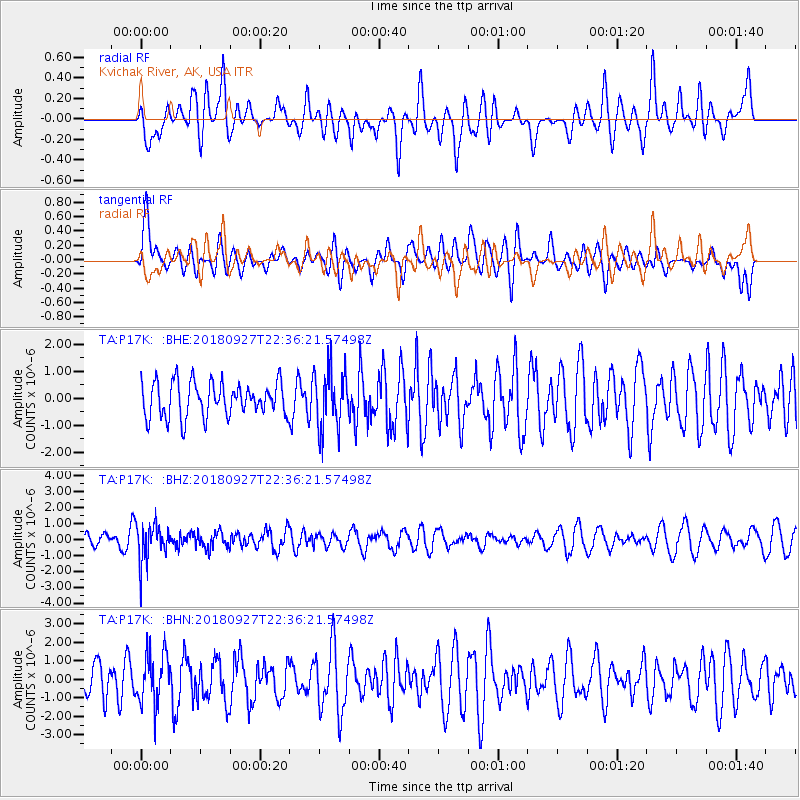
P17K Kvichak River, AK, USA - Earthquake Result Viewer
*The percent match for this event was below the threshold and hence no stack was calculated.
| Earthquake location: |
Fiji Islands Region |
| Earthquake latitude/longitude: |
-18.2/-178.2 |
| Earthquake time(UTC): |
2018/09/27 (270) 22:25:43 GMT |
| Earthquake Depth: |
540 km |
| Earthquake Magnitude: |
5.5 Mww |
| Earthquake Catalog/Contributor: |
NEIC PDE/us |
|
| Network: |
TA USArray Transportable Network (new EarthScope stations) |
| Station: |
P17K Kvichak River, AK, USA |
| Lat/Lon: |
59.20 N/156.44 W |
| Elevation: |
91 m |
|
| Distance: |
79.1 deg |
| Az: |
11.224 deg |
| Baz: |
201.076 deg |
| Ray Param: |
$rayparam |
*The percent match for this event was below the threshold and hence was not used in the summary stack. |
|
| Radial Match: |
52.21073 % |
| Radial Bump: |
400 |
| Transverse Match: |
53.79783 % |
| Transverse Bump: |
400 |
| SOD ConfigId: |
13570011 |
| Insert Time: |
2019-05-01 08:34:01.022 +0000 |
| GWidth: |
2.5 |
| Max Bumps: |
400 |
| Tol: |
0.001 |
|
Signal To Noise
| Channel | StoN | STA | LTA |
| TA:P17K: :BHZ:20180927T22:36:21.57498Z | 2.7432032 | 1.1638832E-6 | 4.242789E-7 |
| TA:P17K: :BHN:20180927T22:36:21.57498Z | 1.5770594 | 1.3999111E-6 | 8.876717E-7 |
| TA:P17K: :BHE:20180927T22:36:21.57498Z | 1.7403225 | 1.107695E-6 | 6.364883E-7 |
| Arrivals |
| Ps | |
| PpPs | |
| PsPs/PpSs | |


