You are here: Home > Network List > IC - New China Digital Seismograph Network Stations List
> Station KMI Kunming, Yunnan Province, China > Earthquake Result Viewer
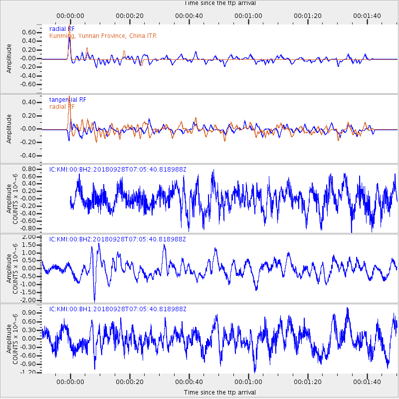
KMI Kunming, Yunnan Province, China - Earthquake Result Viewer
*The percent match for this event was below the threshold and hence no stack was calculated.
| Earthquake location: |
Minahassa Peninsula, Sulawesi |
| Earthquake latitude/longitude: |
-0.4/119.8 |
| Earthquake time(UTC): |
2018/09/28 (271) 07:00:01 GMT |
| Earthquake Depth: |
18 km |
| Earthquake Magnitude: |
6.1 Mww |
| Earthquake Catalog/Contributor: |
NEIC PDE/us |
|
| Network: |
IC New China Digital Seismograph Network |
| Station: |
KMI Kunming, Yunnan Province, China |
| Lat/Lon: |
25.12 N/102.74 E |
| Elevation: |
1975 m |
|
| Distance: |
30.2 deg |
| Az: |
328.211 deg |
| Baz: |
144.47 deg |
| Ray Param: |
$rayparam |
*The percent match for this event was below the threshold and hence was not used in the summary stack. |
|
| Radial Match: |
73.79344 % |
| Radial Bump: |
400 |
| Transverse Match: |
64.17627 % |
| Transverse Bump: |
400 |
| SOD ConfigId: |
13570011 |
| Insert Time: |
2019-05-01 08:41:20.135 +0000 |
| GWidth: |
2.5 |
| Max Bumps: |
400 |
| Tol: |
0.001 |
|
Signal To Noise
| Channel | StoN | STA | LTA |
| IC:KMI:00:BHZ:20180928T07:05:40.818988Z | 2.0876613 | 4.878764E-7 | 2.3369519E-7 |
| IC:KMI:00:BH1:20180928T07:05:40.818988Z | 1.2532911 | 2.895179E-7 | 2.3100611E-7 |
| IC:KMI:00:BH2:20180928T07:05:40.818988Z | 0.85180074 | 1.8650478E-7 | 2.1895353E-7 |
| Arrivals |
| Ps | |
| PpPs | |
| PsPs/PpSs | |


