You are here: Home > Network List > TA - USArray Transportable Network (new EarthScope stations) Stations List
> Station F26K Sheenjek River, AK, USA > Earthquake Result Viewer
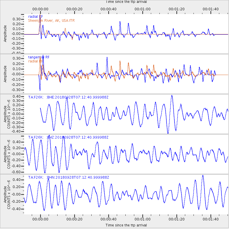
F26K Sheenjek River, AK, USA - Earthquake Result Viewer
*The percent match for this event was below the threshold and hence no stack was calculated.
| Earthquake location: |
Minahassa Peninsula, Sulawesi |
| Earthquake latitude/longitude: |
-0.4/119.8 |
| Earthquake time(UTC): |
2018/09/28 (271) 07:00:01 GMT |
| Earthquake Depth: |
18 km |
| Earthquake Magnitude: |
6.1 Mww |
| Earthquake Catalog/Contributor: |
NEIC PDE/us |
|
| Network: |
TA USArray Transportable Network (new EarthScope stations) |
| Station: |
F26K Sheenjek River, AK, USA |
| Lat/Lon: |
67.69 N/144.15 W |
| Elevation: |
683 m |
|
| Distance: |
92.7 deg |
| Az: |
22.333 deg |
| Baz: |
275.483 deg |
| Ray Param: |
$rayparam |
*The percent match for this event was below the threshold and hence was not used in the summary stack. |
|
| Radial Match: |
57.113842 % |
| Radial Bump: |
400 |
| Transverse Match: |
60.90655 % |
| Transverse Bump: |
400 |
| SOD ConfigId: |
13570011 |
| Insert Time: |
2019-05-01 08:42:37.942 +0000 |
| GWidth: |
2.5 |
| Max Bumps: |
400 |
| Tol: |
0.001 |
|
Signal To Noise
| Channel | StoN | STA | LTA |
| TA:F26K: :BHZ:20180928T07:12:40.999988Z | 2.5561807 | 3.9681765E-7 | 1.552385E-7 |
| TA:F26K: :BHN:20180928T07:12:40.999988Z | 1.4321636 | 2.9938906E-7 | 2.0904669E-7 |
| TA:F26K: :BHE:20180928T07:12:40.999988Z | 0.8296366 | 1.5604759E-7 | 1.880915E-7 |
| Arrivals |
| Ps | |
| PpPs | |
| PsPs/PpSs | |


