You are here: Home > Network List > TA - USArray Transportable Network (new EarthScope stations) Stations List
> Station I30M Mount Dempster, Yukon, CAN > Earthquake Result Viewer
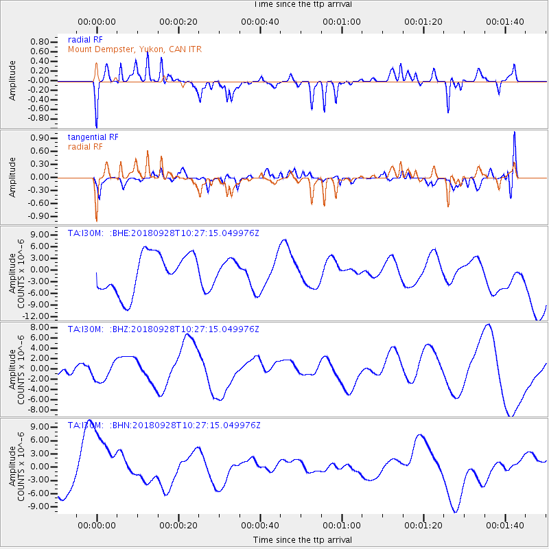
I30M Mount Dempster, Yukon, CAN - Earthquake Result Viewer
*The percent match for this event was below the threshold and hence no stack was calculated.
| Earthquake location: |
Minahassa Peninsula, Sulawesi |
| Earthquake latitude/longitude: |
0.0/119.8 |
| Earthquake time(UTC): |
2018/09/28 (271) 10:14:20 GMT |
| Earthquake Depth: |
10 km |
| Earthquake Magnitude: |
5.8 mb |
| Earthquake Catalog/Contributor: |
NEIC PDE/us |
|
| Network: |
TA USArray Transportable Network (new EarthScope stations) |
| Station: |
I30M Mount Dempster, Yukon, CAN |
| Lat/Lon: |
65.22 N/136.38 W |
| Elevation: |
1399 m |
|
| Distance: |
95.8 deg |
| Az: |
24.283 deg |
| Baz: |
282.62 deg |
| Ray Param: |
$rayparam |
*The percent match for this event was below the threshold and hence was not used in the summary stack. |
|
| Radial Match: |
60.094894 % |
| Radial Bump: |
304 |
| Transverse Match: |
70.94413 % |
| Transverse Bump: |
400 |
| SOD ConfigId: |
13570011 |
| Insert Time: |
2019-05-01 08:56:46.802 +0000 |
| GWidth: |
2.5 |
| Max Bumps: |
400 |
| Tol: |
0.001 |
|
Signal To Noise
| Channel | StoN | STA | LTA |
| TA:I30M: :BHZ:20180928T10:27:15.049976Z | 1.3084226 | 2.022793E-6 | 1.5459784E-6 |
| TA:I30M: :BHN:20180928T10:27:15.049976Z | 2.020257 | 7.285002E-6 | 3.6059778E-6 |
| TA:I30M: :BHE:20180928T10:27:15.049976Z | 0.5162852 | 2.6144396E-6 | 5.0639446E-6 |
| Arrivals |
| Ps | |
| PpPs | |
| PsPs/PpSs | |


