You are here: Home > Network List > TA - USArray Transportable Network (new EarthScope stations) Stations List
> Station M11K Mekoryuk, AK, USA > Earthquake Result Viewer
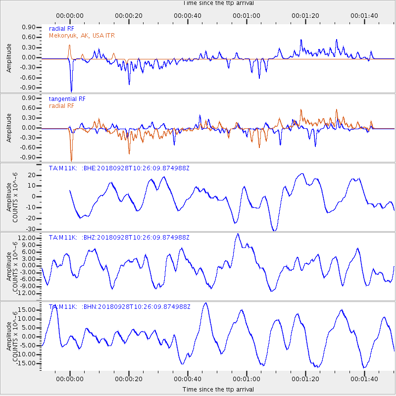
M11K Mekoryuk, AK, USA - Earthquake Result Viewer
*The percent match for this event was below the threshold and hence no stack was calculated.
| Earthquake location: |
Minahassa Peninsula, Sulawesi |
| Earthquake latitude/longitude: |
0.0/119.8 |
| Earthquake time(UTC): |
2018/09/28 (271) 10:14:20 GMT |
| Earthquake Depth: |
10 km |
| Earthquake Magnitude: |
5.8 mb |
| Earthquake Catalog/Contributor: |
NEIC PDE/us |
|
| Network: |
TA USArray Transportable Network (new EarthScope stations) |
| Station: |
M11K Mekoryuk, AK, USA |
| Lat/Lon: |
60.38 N/166.20 W |
| Elevation: |
3.0 m |
|
| Distance: |
82.1 deg |
| Az: |
28.82 deg |
| Baz: |
256.063 deg |
| Ray Param: |
$rayparam |
*The percent match for this event was below the threshold and hence was not used in the summary stack. |
|
| Radial Match: |
71.69658 % |
| Radial Bump: |
331 |
| Transverse Match: |
60.008816 % |
| Transverse Bump: |
285 |
| SOD ConfigId: |
13570011 |
| Insert Time: |
2019-05-01 08:56:55.269 +0000 |
| GWidth: |
2.5 |
| Max Bumps: |
400 |
| Tol: |
0.001 |
|
Signal To Noise
| Channel | StoN | STA | LTA |
| TA:M11K: :BHZ:20180928T10:26:09.874988Z | 0.8347531 | 3.414862E-6 | 4.090865E-6 |
| TA:M11K: :BHN:20180928T10:26:09.874988Z | 0.48810965 | 3.0801566E-6 | 6.3103785E-6 |
| TA:M11K: :BHE:20180928T10:26:09.874988Z | 1.7859219 | 1.6188676E-5 | 9.064605E-6 |
| Arrivals |
| Ps | |
| PpPs | |
| PsPs/PpSs | |


