You are here: Home > Network List > TA - USArray Transportable Network (new EarthScope stations) Stations List
> Station G23K Bananza Creek, AK, USA > Earthquake Result Viewer
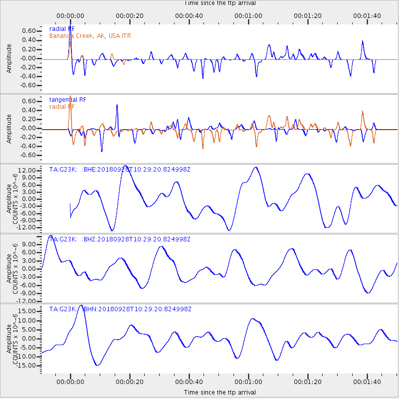
G23K Bananza Creek, AK, USA - Earthquake Result Viewer
*The percent match for this event was below the threshold and hence no stack was calculated.
| Earthquake location: |
Minahassa Peninsula, Sulawesi |
| Earthquake latitude/longitude: |
-0.9/120.0 |
| Earthquake time(UTC): |
2018/09/28 (271) 10:16:49 GMT |
| Earthquake Depth: |
10 km |
| Earthquake Magnitude: |
5.7 mb |
| Earthquake Catalog/Contributor: |
NEIC PDE/us |
|
| Network: |
TA USArray Transportable Network (new EarthScope stations) |
| Station: |
G23K Bananza Creek, AK, USA |
| Lat/Lon: |
66.71 N/150.02 W |
| Elevation: |
746 m |
|
| Distance: |
90.8 deg |
| Az: |
23.432 deg |
| Baz: |
269.603 deg |
| Ray Param: |
$rayparam |
*The percent match for this event was below the threshold and hence was not used in the summary stack. |
|
| Radial Match: |
61.618298 % |
| Radial Bump: |
400 |
| Transverse Match: |
52.50704 % |
| Transverse Bump: |
355 |
| SOD ConfigId: |
13570011 |
| Insert Time: |
2019-05-01 09:00:19.684 +0000 |
| GWidth: |
2.5 |
| Max Bumps: |
400 |
| Tol: |
0.001 |
|
Signal To Noise
| Channel | StoN | STA | LTA |
| TA:G23K: :BHZ:20180928T10:29:20.824998Z | 0.2210857 | 2.0527673E-6 | 9.28494E-6 |
| TA:G23K: :BHN:20180928T10:29:20.824998Z | 3.3741007 | 1.376361E-5 | 4.0791933E-6 |
| TA:G23K: :BHE:20180928T10:29:20.824998Z | 0.25904542 | 1.8180801E-6 | 7.0183837E-6 |
| Arrivals |
| Ps | |
| PpPs | |
| PsPs/PpSs | |


