You are here: Home > Network List > TA - USArray Transportable Network (new EarthScope stations) Stations List
> Station J26L Joseph Creek, AK, USA > Earthquake Result Viewer
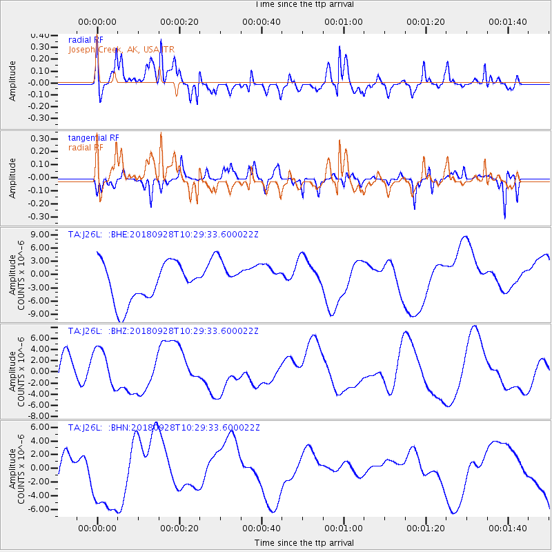
J26L Joseph Creek, AK, USA - Earthquake Result Viewer
*The percent match for this event was below the threshold and hence no stack was calculated.
| Earthquake location: |
Minahassa Peninsula, Sulawesi |
| Earthquake latitude/longitude: |
-0.9/120.0 |
| Earthquake time(UTC): |
2018/09/28 (271) 10:16:49 GMT |
| Earthquake Depth: |
10 km |
| Earthquake Magnitude: |
5.7 mb |
| Earthquake Catalog/Contributor: |
NEIC PDE/us |
|
| Network: |
TA USArray Transportable Network (new EarthScope stations) |
| Station: |
J26L Joseph Creek, AK, USA |
| Lat/Lon: |
64.50 N/143.56 W |
| Elevation: |
1144 m |
|
| Distance: |
93.6 deg |
| Az: |
25.53 deg |
| Baz: |
275.402 deg |
| Ray Param: |
$rayparam |
*The percent match for this event was below the threshold and hence was not used in the summary stack. |
|
| Radial Match: |
51.11351 % |
| Radial Bump: |
386 |
| Transverse Match: |
34.550285 % |
| Transverse Bump: |
267 |
| SOD ConfigId: |
13570011 |
| Insert Time: |
2019-05-01 09:00:23.962 +0000 |
| GWidth: |
2.5 |
| Max Bumps: |
400 |
| Tol: |
0.001 |
|
Signal To Noise
| Channel | StoN | STA | LTA |
| TA:J26L: :BHZ:20180928T10:29:33.600022Z | 0.70222133 | 3.5590613E-6 | 5.0682897E-6 |
| TA:J26L: :BHN:20180928T10:29:33.600022Z | 3.048388 | 5.9577433E-6 | 1.9543913E-6 |
| TA:J26L: :BHE:20180928T10:29:33.600022Z | 0.9228109 | 4.0052537E-6 | 4.3402756E-6 |
| Arrivals |
| Ps | |
| PpPs | |
| PsPs/PpSs | |


