You are here: Home > Network List > TA - USArray Transportable Network (new EarthScope stations) Stations List
> Station M31M Drury Creek, Yukon, CA > Earthquake Result Viewer
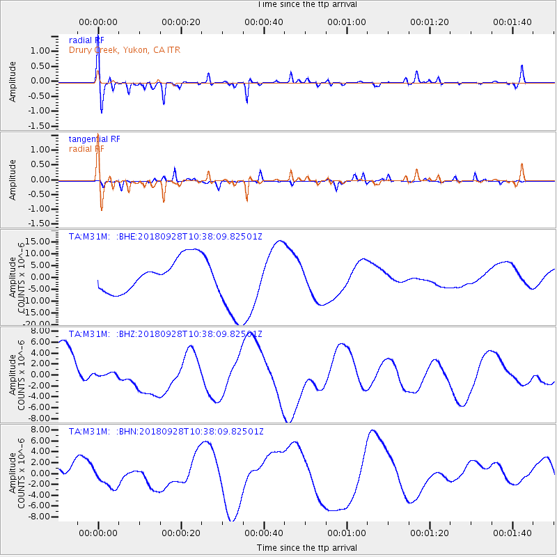
M31M Drury Creek, Yukon, CA - Earthquake Result Viewer
*The percent match for this event was below the threshold and hence no stack was calculated.
| Earthquake location: |
Sulawesi, Indonesia |
| Earthquake latitude/longitude: |
-1.1/120.0 |
| Earthquake time(UTC): |
2018/09/28 (271) 10:25:04 GMT |
| Earthquake Depth: |
10 km |
| Earthquake Magnitude: |
5.8 mb |
| Earthquake Catalog/Contributor: |
NEIC PDE/us |
|
| Network: |
TA USArray Transportable Network (new EarthScope stations) |
| Station: |
M31M Drury Creek, Yukon, CA |
| Lat/Lon: |
62.20 N/134.39 W |
| Elevation: |
639 m |
|
| Distance: |
98.2 deg |
| Az: |
27.135 deg |
| Baz: |
283.412 deg |
| Ray Param: |
$rayparam |
*The percent match for this event was below the threshold and hence was not used in the summary stack. |
|
| Radial Match: |
35.78707 % |
| Radial Bump: |
342 |
| Transverse Match: |
57.29828 % |
| Transverse Bump: |
254 |
| SOD ConfigId: |
13570011 |
| Insert Time: |
2019-05-01 09:04:05.261 +0000 |
| GWidth: |
2.5 |
| Max Bumps: |
400 |
| Tol: |
0.001 |
|
Signal To Noise
| Channel | StoN | STA | LTA |
| TA:M31M: :BHZ:20180928T10:38:09.82501Z | 0.13612898 | 5.464096E-7 | 4.0139107E-6 |
| TA:M31M: :BHN:20180928T10:38:09.82501Z | 0.73008615 | 1.8419406E-6 | 2.5229087E-6 |
| TA:M31M: :BHE:20180928T10:38:09.82501Z | 2.4337199 | 1.6672926E-5 | 6.850799E-6 |
| Arrivals |
| Ps | |
| PpPs | |
| PsPs/PpSs | |


