You are here: Home > Network List > TA - USArray Transportable Network (new EarthScope stations) Stations List
> Station J26L Joseph Creek, AK, USA > Earthquake Result Viewer
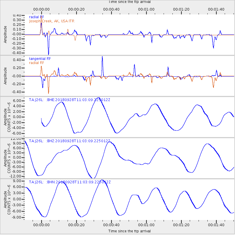
J26L Joseph Creek, AK, USA - Earthquake Result Viewer
*The percent match for this event was below the threshold and hence no stack was calculated.
| Earthquake location: |
Minahassa Peninsula, Sulawesi |
| Earthquake latitude/longitude: |
-0.8/119.9 |
| Earthquake time(UTC): |
2018/09/28 (271) 10:50:25 GMT |
| Earthquake Depth: |
10 km |
| Earthquake Magnitude: |
5.7 mb |
| Earthquake Catalog/Contributor: |
NEIC PDE/us |
|
| Network: |
TA USArray Transportable Network (new EarthScope stations) |
| Station: |
J26L Joseph Creek, AK, USA |
| Lat/Lon: |
64.50 N/143.56 W |
| Elevation: |
1144 m |
|
| Distance: |
93.5 deg |
| Az: |
25.523 deg |
| Baz: |
275.531 deg |
| Ray Param: |
$rayparam |
*The percent match for this event was below the threshold and hence was not used in the summary stack. |
|
| Radial Match: |
81.5382 % |
| Radial Bump: |
400 |
| Transverse Match: |
65.24153 % |
| Transverse Bump: |
139 |
| SOD ConfigId: |
13570011 |
| Insert Time: |
2019-05-01 09:06:44.446 +0000 |
| GWidth: |
2.5 |
| Max Bumps: |
400 |
| Tol: |
0.001 |
|
Signal To Noise
| Channel | StoN | STA | LTA |
| TA:J26L: :BHZ:20180928T11:03:09.225012Z | 1.549258 | 9.846875E-6 | 6.355865E-6 |
| TA:J26L: :BHN:20180928T11:03:09.225012Z | 3.0912561 | 8.187511E-6 | 2.6486034E-6 |
| TA:J26L: :BHE:20180928T11:03:09.225012Z | 1.7814642 | 6.960917E-6 | 3.9074134E-6 |
| Arrivals |
| Ps | |
| PpPs | |
| PsPs/PpSs | |


