You are here: Home > Network List > TA - USArray Transportable Network (new EarthScope stations) Stations List
> Station POKR Poker Plat Research Range, AK, USA > Earthquake Result Viewer
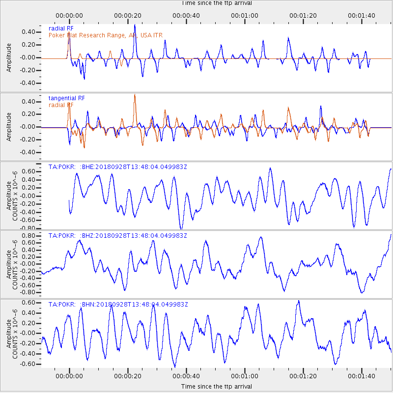
POKR Poker Plat Research Range, AK, USA - Earthquake Result Viewer
*The percent match for this event was below the threshold and hence no stack was calculated.
| Earthquake location: |
Minahassa Peninsula, Sulawesi |
| Earthquake latitude/longitude: |
0.1/119.7 |
| Earthquake time(UTC): |
2018/09/28 (271) 13:35:30 GMT |
| Earthquake Depth: |
10 km |
| Earthquake Magnitude: |
5.7 Ms_20 |
| Earthquake Catalog/Contributor: |
NEIC PDE/us |
|
| Network: |
TA USArray Transportable Network (new EarthScope stations) |
| Station: |
POKR Poker Plat Research Range, AK, USA |
| Lat/Lon: |
65.12 N/147.43 W |
| Elevation: |
501 m |
|
| Distance: |
91.2 deg |
| Az: |
25.002 deg |
| Baz: |
272.638 deg |
| Ray Param: |
$rayparam |
*The percent match for this event was below the threshold and hence was not used in the summary stack. |
|
| Radial Match: |
64.095245 % |
| Radial Bump: |
354 |
| Transverse Match: |
63.281425 % |
| Transverse Bump: |
391 |
| SOD ConfigId: |
13570011 |
| Insert Time: |
2019-05-01 09:10:15.562 +0000 |
| GWidth: |
2.5 |
| Max Bumps: |
400 |
| Tol: |
0.001 |
|
Signal To Noise
| Channel | StoN | STA | LTA |
| TA:POKR: :BHZ:20180928T13:48:04.049983Z | 2.8455217 | 5.10583E-7 | 1.794339E-7 |
| TA:POKR: :BHN:20180928T13:48:04.049983Z | 1.3310633 | 3.0242757E-7 | 2.2720751E-7 |
| TA:POKR: :BHE:20180928T13:48:04.049983Z | 0.763916 | 2.4058323E-7 | 3.1493414E-7 |
| Arrivals |
| Ps | |
| PpPs | |
| PsPs/PpSs | |


