You are here: Home > Network List > BK - Berkeley Digital Seismograph Network Stations List
> Station HUMO Hull Mountain, OR > Earthquake Result Viewer
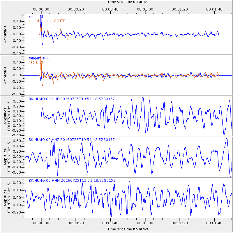
HUMO Hull Mountain, OR - Earthquake Result Viewer
*The percent match for this event was below the threshold and hence no stack was calculated.
| Earthquake location: |
Admiralty Islands Region, P.N.G. |
| Earthquake latitude/longitude: |
-2.9/148.0 |
| Earthquake time(UTC): |
2016/07/25 (207) 19:38:44 GMT |
| Earthquake Depth: |
6.5 km |
| Earthquake Magnitude: |
6.3 MO |
| Earthquake Catalog/Contributor: |
NEIC PDE/NEIC ALERT |
|
| Network: |
BK Berkeley Digital Seismograph Network |
| Station: |
HUMO Hull Mountain, OR |
| Lat/Lon: |
42.61 N/122.96 W |
| Elevation: |
555 m |
|
| Distance: |
91.3 deg |
| Az: |
47.592 deg |
| Baz: |
267.21 deg |
| Ray Param: |
$rayparam |
*The percent match for this event was below the threshold and hence was not used in the summary stack. |
|
| Radial Match: |
74.92734 % |
| Radial Bump: |
400 |
| Transverse Match: |
61.12893 % |
| Transverse Bump: |
400 |
| SOD ConfigId: |
1634031 |
| Insert Time: |
2016-08-08 19:39:27.513 +0000 |
| GWidth: |
2.5 |
| Max Bumps: |
400 |
| Tol: |
0.001 |
|
Signal To Noise
| Channel | StoN | STA | LTA |
| BK:HUMO:00:HHZ:20160725T19:51:18.528015Z | 2.1569178 | 2.0479771E-7 | 9.494924E-8 |
| BK:HUMO:00:HHN:20160725T19:51:18.528015Z | 1.1064192 | 8.19256E-8 | 7.4045715E-8 |
| BK:HUMO:00:HHE:20160725T19:51:18.528015Z | 1.2772914 | 1.1429951E-7 | 8.9485845E-8 |
| Arrivals |
| Ps | |
| PpPs | |
| PsPs/PpSs | |


