You are here: Home > Network List > G - GEOSCOPE Stations List
> Station RER Riviere de l'Est, La Reunion (Indian Ocean) > Earthquake Result Viewer
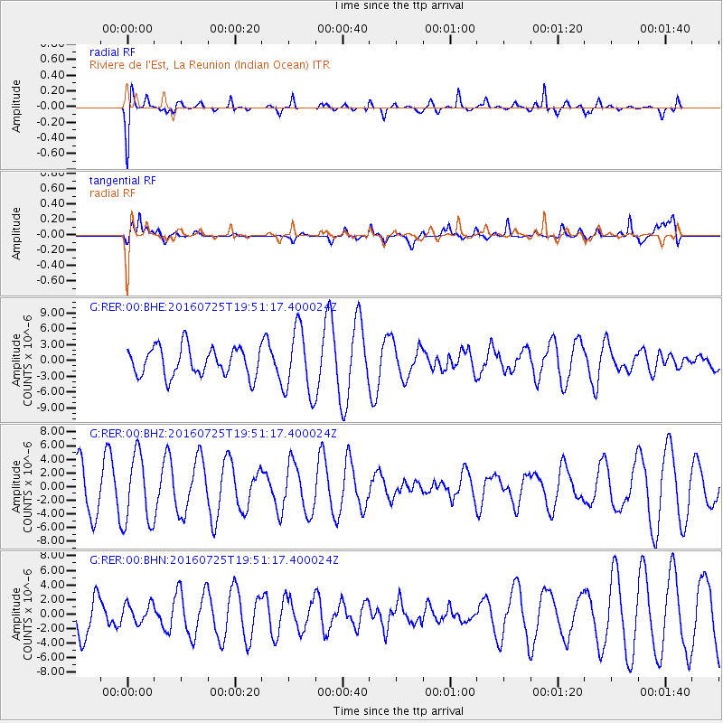
RER Riviere de l'Est, La Reunion (Indian Ocean) - Earthquake Result Viewer
*The percent match for this event was below the threshold and hence no stack was calculated.
| Earthquake location: |
Admiralty Islands Region, P.N.G. |
| Earthquake latitude/longitude: |
-2.9/148.0 |
| Earthquake time(UTC): |
2016/07/25 (207) 19:38:44 GMT |
| Earthquake Depth: |
6.5 km |
| Earthquake Magnitude: |
6.3 MO |
| Earthquake Catalog/Contributor: |
NEIC PDE/NEIC ALERT |
|
| Network: |
G GEOSCOPE |
| Station: |
RER Riviere de l'Est, La Reunion (Indian Ocean) |
| Lat/Lon: |
21.16 S/55.75 E |
| Elevation: |
834 m |
|
| Distance: |
91.0 deg |
| Az: |
248.881 deg |
| Baz: |
93.531 deg |
| Ray Param: |
$rayparam |
*The percent match for this event was below the threshold and hence was not used in the summary stack. |
|
| Radial Match: |
73.071266 % |
| Radial Bump: |
318 |
| Transverse Match: |
65.05825 % |
| Transverse Bump: |
360 |
| SOD ConfigId: |
1634031 |
| Insert Time: |
2016-08-08 19:40:27.697 +0000 |
| GWidth: |
2.5 |
| Max Bumps: |
400 |
| Tol: |
0.001 |
|
Signal To Noise
| Channel | StoN | STA | LTA |
| G:RER:00:BHZ:20160725T19:51:17.400024Z | 0.8794142 | 5.0600893E-6 | 5.7539314E-6 |
| G:RER:00:BHN:20160725T19:51:17.400024Z | 0.272647 | 1.300487E-6 | 4.7698563E-6 |
| G:RER:00:BHE:20160725T19:51:17.400024Z | 2.3041513 | 6.229743E-6 | 2.703704E-6 |
| Arrivals |
| Ps | |
| PpPs | |
| PsPs/PpSs | |


