You are here: Home > Network List > TA - USArray Transportable Network (new EarthScope stations) Stations List
> Station M31M Drury Creek, Yukon, CA > Earthquake Result Viewer
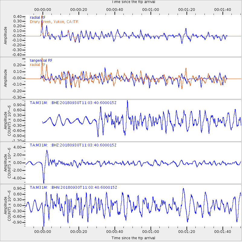
M31M Drury Creek, Yukon, CA - Earthquake Result Viewer
*The percent match for this event was below the threshold and hence no stack was calculated.
| Earthquake location: |
Fiji Islands Region |
| Earthquake latitude/longitude: |
-18.4/-178.1 |
| Earthquake time(UTC): |
2018/09/30 (273) 10:52:23 GMT |
| Earthquake Depth: |
551 km |
| Earthquake Magnitude: |
6.6 mww |
| Earthquake Catalog/Contributor: |
NEIC PDE/us |
|
| Network: |
TA USArray Transportable Network (new EarthScope stations) |
| Station: |
M31M Drury Creek, Yukon, CA |
| Lat/Lon: |
62.20 N/134.39 W |
| Elevation: |
639 m |
|
| Distance: |
87.4 deg |
| Az: |
18.92 deg |
| Baz: |
221.058 deg |
| Ray Param: |
$rayparam |
*The percent match for this event was below the threshold and hence was not used in the summary stack. |
|
| Radial Match: |
64.97465 % |
| Radial Bump: |
400 |
| Transverse Match: |
73.7019 % |
| Transverse Bump: |
400 |
| SOD ConfigId: |
13570011 |
| Insert Time: |
2019-05-01 09:21:15.512 +0000 |
| GWidth: |
2.5 |
| Max Bumps: |
400 |
| Tol: |
0.001 |
|
Signal To Noise
| Channel | StoN | STA | LTA |
| TA:M31M: :BHZ:20180930T11:03:40.600015Z | 6.1094236 | 2.1444866E-6 | 3.5101291E-7 |
| TA:M31M: :BHN:20180930T11:03:40.600015Z | 2.834463 | 4.464661E-7 | 1.5751347E-7 |
| TA:M31M: :BHE:20180930T11:03:40.600015Z | 2.965375 | 4.576559E-7 | 1.5433322E-7 |
| Arrivals |
| Ps | |
| PpPs | |
| PsPs/PpSs | |


