You are here: Home > Network List > TA - USArray Transportable Network (new EarthScope stations) Stations List
> Station F26K Sheenjek River, AK, USA > Earthquake Result Viewer
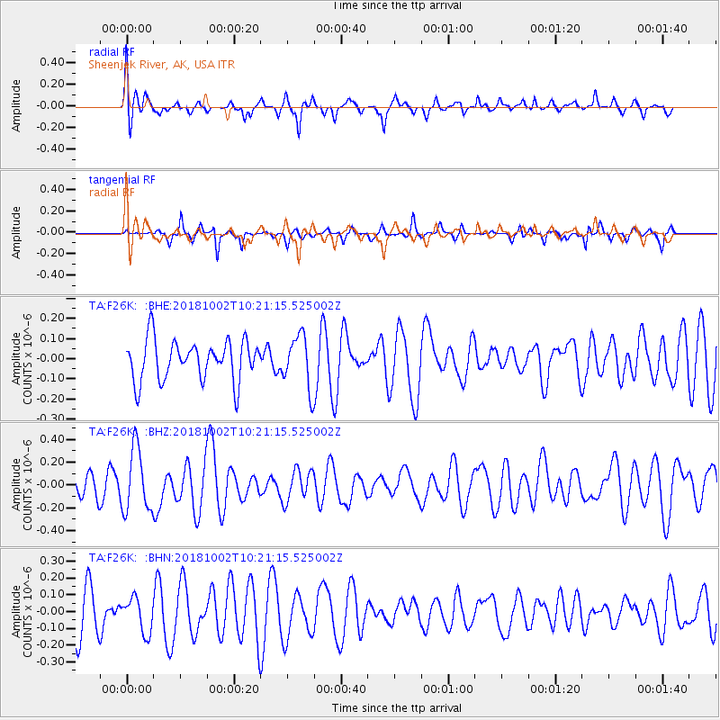
F26K Sheenjek River, AK, USA - Earthquake Result Viewer
*The percent match for this event was below the threshold and hence no stack was calculated.
| Earthquake location: |
Vanuatu Islands |
| Earthquake latitude/longitude: |
-17.8/167.9 |
| Earthquake time(UTC): |
2018/10/02 (275) 10:08:37 GMT |
| Earthquake Depth: |
10 km |
| Earthquake Magnitude: |
5.6 Mww |
| Earthquake Catalog/Contributor: |
NEIC PDE/us |
|
| Network: |
TA USArray Transportable Network (new EarthScope stations) |
| Station: |
F26K Sheenjek River, AK, USA |
| Lat/Lon: |
67.69 N/144.15 W |
| Elevation: |
683 m |
|
| Distance: |
92.2 deg |
| Az: |
16.493 deg |
| Baz: |
225.11 deg |
| Ray Param: |
$rayparam |
*The percent match for this event was below the threshold and hence was not used in the summary stack. |
|
| Radial Match: |
56.69507 % |
| Radial Bump: |
372 |
| Transverse Match: |
50.208057 % |
| Transverse Bump: |
257 |
| SOD ConfigId: |
13570011 |
| Insert Time: |
2019-05-01 09:40:49.101 +0000 |
| GWidth: |
2.5 |
| Max Bumps: |
400 |
| Tol: |
0.001 |
|
Signal To Noise
| Channel | StoN | STA | LTA |
| TA:F26K: :BHZ:20181002T10:21:15.525002Z | 2.3380046 | 2.7798347E-7 | 1.18897745E-7 |
| TA:F26K: :BHN:20181002T10:21:15.525002Z | 0.76023006 | 1.0374635E-7 | 1.3646704E-7 |
| TA:F26K: :BHE:20181002T10:21:15.525002Z | 1.3178437 | 1.3248635E-7 | 1.0053268E-7 |
| Arrivals |
| Ps | |
| PpPs | |
| PsPs/PpSs | |


