You are here: Home > Network List > TA - USArray Transportable Network (new EarthScope stations) Stations List
> Station U18A Rough Rock, Chinle, AZ, USA > Earthquake Result Viewer
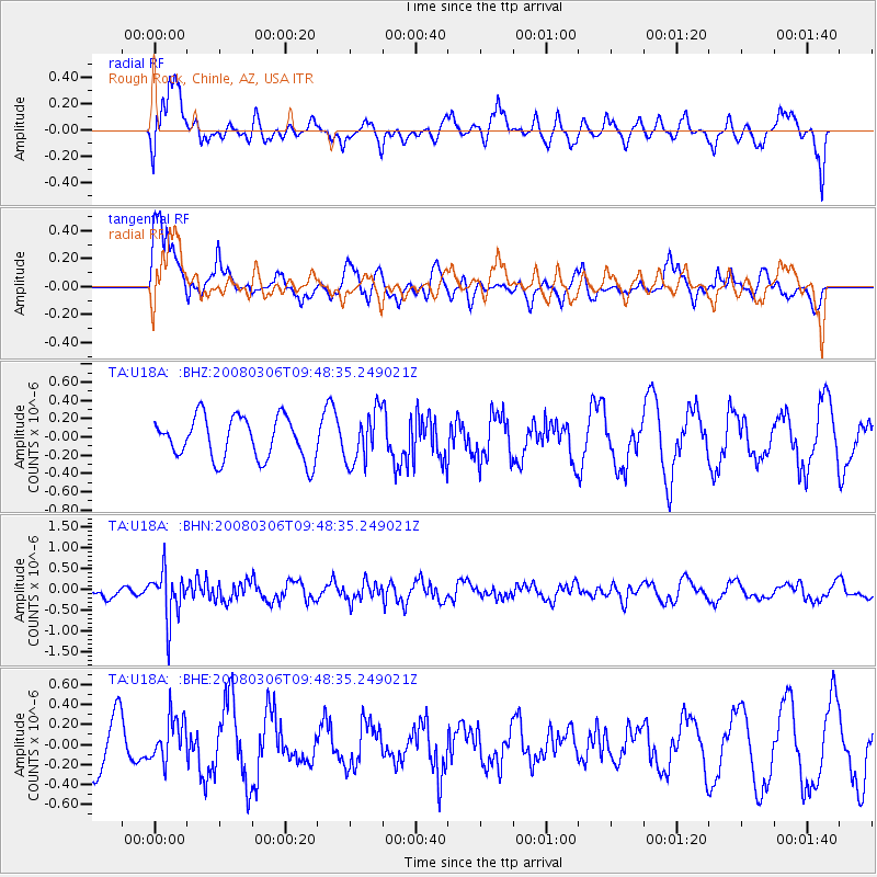
U18A Rough Rock, Chinle, AZ, USA - Earthquake Result Viewer
*The percent match for this event was below the threshold and hence no stack was calculated.
| Earthquake location: |
Kamchatka Peninsula, Russia |
| Earthquake latitude/longitude: |
51.5/156.5 |
| Earthquake time(UTC): |
2008/03/06 (066) 09:38:43 GMT |
| Earthquake Depth: |
134 km |
| Earthquake Magnitude: |
5.6 MB, 5.5 MW, 5.5 MW |
| Earthquake Catalog/Contributor: |
WHDF/NEIC |
|
| Network: |
TA USArray Transportable Network (new EarthScope stations) |
| Station: |
U18A Rough Rock, Chinle, AZ, USA |
| Lat/Lon: |
36.42 N/109.87 W |
| Elevation: |
1878 m |
|
| Distance: |
64.5 deg |
| Az: |
63.084 deg |
| Baz: |
316.316 deg |
| Ray Param: |
$rayparam |
*The percent match for this event was below the threshold and hence was not used in the summary stack. |
|
| Radial Match: |
44.113403 % |
| Radial Bump: |
400 |
| Transverse Match: |
52.082153 % |
| Transverse Bump: |
396 |
| SOD ConfigId: |
2504 |
| Insert Time: |
2010-03-06 16:25:46.150 +0000 |
| GWidth: |
2.5 |
| Max Bumps: |
400 |
| Tol: |
0.001 |
|
Signal To Noise
| Channel | StoN | STA | LTA |
| TA:U18A: :BHN:20080306T09:48:35.249021Z | 3.4900365 | 5.8112835E-7 | 1.6651069E-7 |
| TA:U18A: :BHE:20080306T09:48:35.249021Z | 0.87897056 | 2.1641483E-7 | 2.4621397E-7 |
| TA:U18A: :BHZ:20080306T09:48:35.249021Z | 1.2011112 | 2.7611858E-7 | 2.2988596E-7 |
| Arrivals |
| Ps | |
| PpPs | |
| PsPs/PpSs | |


