You are here: Home > Network List > TA - USArray Transportable Network (new EarthScope stations) Stations List
> Station 435B Jarrell, TX, USA > Earthquake Result Viewer
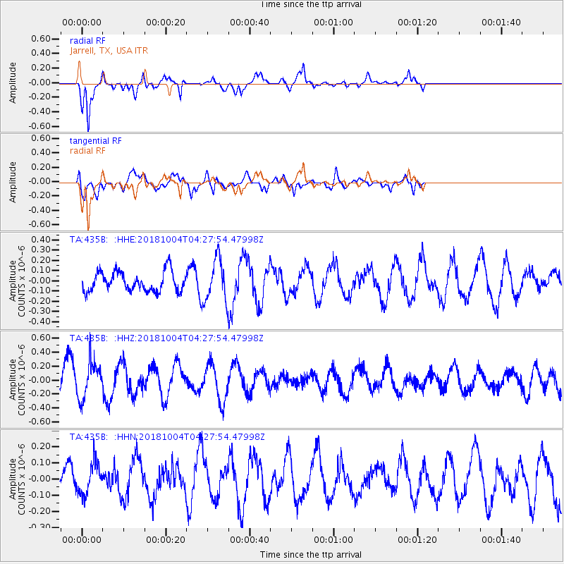
435B Jarrell, TX, USA - Earthquake Result Viewer
*The percent match for this event was below the threshold and hence no stack was calculated.
| Earthquake location: |
Fiji Islands Region |
| Earthquake latitude/longitude: |
-17.9/-178.5 |
| Earthquake time(UTC): |
2018/10/04 (277) 04:16:21 GMT |
| Earthquake Depth: |
579 km |
| Earthquake Magnitude: |
5.5 Mww |
| Earthquake Catalog/Contributor: |
NEIC PDE/us |
|
| Network: |
TA USArray Transportable Network (new EarthScope stations) |
| Station: |
435B Jarrell, TX, USA |
| Lat/Lon: |
30.78 N/97.58 W |
| Elevation: |
248 m |
|
| Distance: |
91.5 deg |
| Az: |
58.235 deg |
| Baz: |
250.197 deg |
| Ray Param: |
$rayparam |
*The percent match for this event was below the threshold and hence was not used in the summary stack. |
|
| Radial Match: |
68.62866 % |
| Radial Bump: |
366 |
| Transverse Match: |
70.52193 % |
| Transverse Bump: |
400 |
| SOD ConfigId: |
13570011 |
| Insert Time: |
2019-05-01 09:48:28.258 +0000 |
| GWidth: |
2.5 |
| Max Bumps: |
400 |
| Tol: |
0.001 |
|
Signal To Noise
| Channel | StoN | STA | LTA |
| TA:435B: :HHZ:20181004T04:27:54.47998Z | 1.6289409 | 2.6803917E-7 | 1.6454813E-7 |
| TA:435B: :HHN:20181004T04:27:54.47998Z | 0.9945422 | 1.0103411E-7 | 1.0158857E-7 |
| TA:435B: :HHE:20181004T04:27:54.47998Z | 2.3595045 | 2.2857658E-7 | 9.687483E-8 |
| Arrivals |
| Ps | |
| PpPs | |
| PsPs/PpSs | |


