You are here: Home > Network List > AZ - ANZA Regional Network Stations List
> Station SMER AZ.SMER > Earthquake Result Viewer
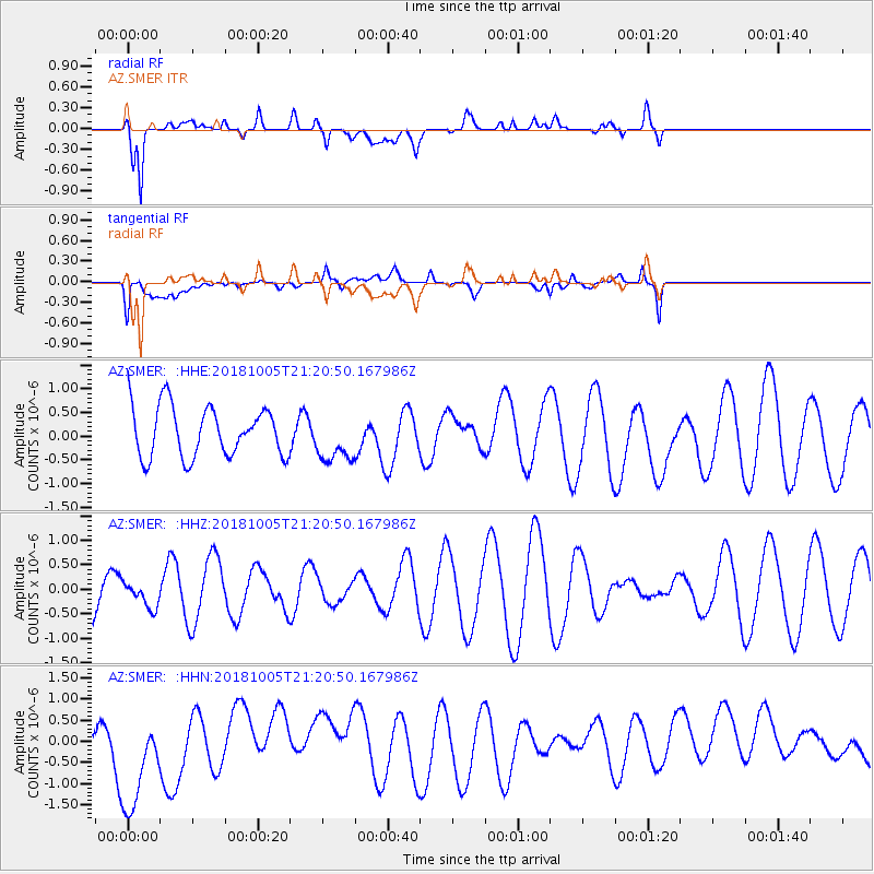
SMER AZ.SMER - Earthquake Result Viewer
*The percent match for this event was below the threshold and hence no stack was calculated.
| Earthquake location: |
Southeast Of Loyalty Islands |
| Earthquake latitude/longitude: |
-22.0/169.6 |
| Earthquake time(UTC): |
2018/10/05 (278) 21:08:26 GMT |
| Earthquake Depth: |
5.6 km |
| Earthquake Magnitude: |
5.4 Mww |
| Earthquake Catalog/Contributor: |
NEIC PDE/us |
|
| Network: |
AZ ANZA Regional Network |
| Station: |
SMER AZ.SMER |
| Lat/Lon: |
33.46 N/117.17 W |
| Elevation: |
355 m |
|
| Distance: |
88.9 deg |
| Az: |
53.186 deg |
| Baz: |
242.733 deg |
| Ray Param: |
$rayparam |
*The percent match for this event was below the threshold and hence was not used in the summary stack. |
|
| Radial Match: |
65.91516 % |
| Radial Bump: |
400 |
| Transverse Match: |
24.03757 % |
| Transverse Bump: |
400 |
| SOD ConfigId: |
13570011 |
| Insert Time: |
2019-05-01 09:58:50.680 +0000 |
| GWidth: |
2.5 |
| Max Bumps: |
400 |
| Tol: |
0.001 |
|
Signal To Noise
| Channel | StoN | STA | LTA |
| AZ:SMER: :HHZ:20181005T21:20:50.167986Z | 0.20898664 | 2.6629382E-7 | 1.2742145E-6 |
| AZ:SMER: :HHN:20181005T21:20:50.167986Z | 1.5721428 | 1.515804E-6 | 9.641642E-7 |
| AZ:SMER: :HHE:20181005T21:20:50.167986Z | 0.9733905 | 5.160898E-7 | 5.301981E-7 |
| Arrivals |
| Ps | |
| PpPs | |
| PsPs/PpSs | |


