You are here: Home > Network List > TA - USArray Transportable Network (new EarthScope stations) Stations List
> Station R31K City Hall, Gustavus, AK, USA > Earthquake Result Viewer
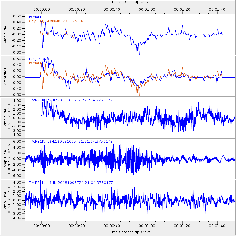
R31K City Hall, Gustavus, AK, USA - Earthquake Result Viewer
*The percent match for this event was below the threshold and hence no stack was calculated.
| Earthquake location: |
Southeast Of Loyalty Islands |
| Earthquake latitude/longitude: |
-22.0/169.6 |
| Earthquake time(UTC): |
2018/10/05 (278) 21:08:26 GMT |
| Earthquake Depth: |
5.6 km |
| Earthquake Magnitude: |
5.4 Mww |
| Earthquake Catalog/Contributor: |
NEIC PDE/us |
|
| Network: |
TA USArray Transportable Network (new EarthScope stations) |
| Station: |
R31K City Hall, Gustavus, AK, USA |
| Lat/Lon: |
58.41 N/135.74 W |
| Elevation: |
15 m |
|
| Distance: |
91.9 deg |
| Az: |
25.442 deg |
| Baz: |
229.252 deg |
| Ray Param: |
$rayparam |
*The percent match for this event was below the threshold and hence was not used in the summary stack. |
|
| Radial Match: |
32.99488 % |
| Radial Bump: |
400 |
| Transverse Match: |
23.72882 % |
| Transverse Bump: |
400 |
| SOD ConfigId: |
13570011 |
| Insert Time: |
2019-05-01 10:01:48.442 +0000 |
| GWidth: |
2.5 |
| Max Bumps: |
400 |
| Tol: |
0.001 |
|
Signal To Noise
| Channel | StoN | STA | LTA |
| TA:R31K: :BHZ:20181005T21:21:04.375017Z | 1.9440029 | 2.1727842E-6 | 1.1176858E-6 |
| TA:R31K: :BHN:20181005T21:21:04.375017Z | 1.7960048 | 1.492476E-6 | 8.3099786E-7 |
| TA:R31K: :BHE:20181005T21:21:04.375017Z | 1.0460175 | 1.5538155E-6 | 1.4854584E-6 |
| Arrivals |
| Ps | |
| PpPs | |
| PsPs/PpSs | |


